The NSW National Parks and Wildlife Service (NPWS) will be conducting a hazard reduction burn in Brisbane Water National Park beginning Saturday 16 September.
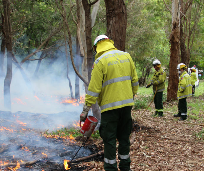
The 40-hectare burn is stage 1 of a larger 147-hectare burn, which will reduce naturally accumulated fuel loads in the park to protect nearby residential areas in Kariong from future bushfires.
The burn, located south-east of Kariong, is scheduled to begin at 5 pm on Saturday afternoon, with mop-up and patrol continuing through to Monday. Closures will be in place on Bambara Road, Corrumbine Creek, Koolewong, Lyre Trig and Milyerra fire trails, as well as informal walking tracks for the duration of the burn. The tracks and trails will be reopened once the area is deemed safe.
Smoke may be visible from the M1 Pacific Motorway, Central Coast Highway, Woy Woy Road, Brisbane Water Drive and residential areas of Kariong, Point Clare and Tascott.
People vulnerable to smoke are encouraged to stay indoors and keep doors and windows closed to reduce exposure.
Hazard reduction burns are essential to reduce bushfire fuel loads to help protect parks, neighbours and communities from future bushfires. This burn is one of many hazard reduction operations undertaken by NPWS each year, many with assistance from the Rural Fire Service and Fire and Rescue NSW. All burns around the state are coordinated with the NSW Rural Fire Service to ensure the impact on the community is assessed at a regional level.


