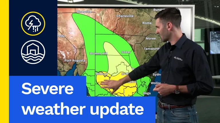
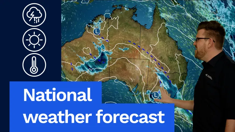
We have Flood Watches current for large parts of Victoria. Severe thunderstorms also possible, damaging winds possible as well. A very active 24 hours through parts of Victoria, New South Wales and, early on, through eastern South Australia. And for the latest on that you can check our severe weather video as well online.
Elsewhere, though, pretty quiet north around Newcastle and much of the Queensland coast with fine and partly cloudy conditions with those onshore winds. We’re going to see widespread rain and storms as well through inland parts of WA on Friday afternoon and evening. Heavy falls there as well but it is mostly the desert. While you can see high pressure keeping much of Tasmania, South Australia, southern WA and also much of northern Australia fine as well. But let’s have a look at all this weather in more detail.
Firstly, in Queensland, you can see a very nice day for much of the state with temperatures, you know, in the high 20s for much of our coastal areas getting up into the high 30s through the far northern areas and also mid 30s through western areas as well. We’ll be watching this trough line move into south-western parts of the state later in the day. That might bring a few showers and an isolated thunderstorm around the New South Wales border, through southern inland areas, but elsewhere it will remain dry with lots of sunshine. South-eastern Queensland also looking at a fine and partly cloudy day as well. A little bit cooler on the coast with those south-easterly breezes but staying dry. 26 °C and partly cloudy in Brisbane.
Moving down into New South Wales, and while north-eastern parts of the state will be dry and partly cloudy, with temperatures in the mid to high 20s it’s going to be very active here through southern and also eastern parts of New South Wales. Severe thunderstorms quite possible around the Riverina area and southern inland New South Wales. That will extend to the central and southern ranges in the late afternoon and evening, with rain also getting towards our coastal areas south of about Newcastle in the late afternoon and evening as well. Heavy falls likely through south-eastern parts of New South Wales as well, not only with thunderstorms, with widespread heavy rainfall slowly moving through, as that upper low looks to sit around southern New South Wales by Friday night. Sydney looking at a fine start and 26 °C. Cloud increasing. Rain and thunderstorms developing towards late afternoon and evening and overnight hours. Canberra looking at a wet and cloudy day. A bit of wind as well. Lots of rainfall, about 20-30 mm possible, even more, and 19 °C.
Moving down to Victoria, and a very active day. We’re going to have a band of rain in the morning through eastern and northern parts with embedded thunderstorms, and then it’ll take a break during the early afternoon before more widespread rain and thunderstorms develop through western, northern and eastern parts of the state as well. Flood Watches current for much of northern and eastern Victoria. Heavy falls likely, with rainfall through northern and eastern Victoria. Severe thunderstorms also likely through much of the state with heavy rainfall, the most likely threat. And flash flooding a big risk through parts of Victoria, particularly under those thunderstorms. So, a wet, mild and almost humid day tomorrow across parts of Victoria. It will be cooler, though, in southern areas with south to south-easterly winds. Temperatures there in the mid to high teens getting into the low 20s through northern areas, particularly if any breaks between those rain and storms. Melbourne looking at a wet Friday morning, a bit of a break during the day and wet afternoon and evening, 17 °C with rain moving through from time to time.
Moving down into Tasmania, and high pressure protecting them from all that rain further north. So, we do see a fine, partly cloudy day for much of the state. Temperatures in the mid to high teens statewide. Maybe just an isolated south of the Central Plateau or in far north-western Tasmania. Otherwise staying fairly fine and dry. 16 °C and partly cloudy in Hobart.
Moving up into South Australia and we’re going to see that rain and storms through eastern and southern parts of South Australia to start the day on Friday, and that’ll slowly contract eastwards into Victoria during the afternoon and evening, and mostly clearing South Australia by Friday night. Still, those showers and wet conditions in the early hours. You can see here through southern South Australia, clearing during the afternoon hours. Cool in the south with those southerly winds. Only 19 °C or 20 °C for many, even cooler down towards Mount Gambier but further north we’ll see warm temperatures and temperatures in the mid to high 20s there, and into low 30s in the far north-east. Staying dry up there as well. Adelaide looking at some morning rain and showers. Clearing by late afternoon and 19 °C.
Moving over into WA, and while southern areas will stay quiet, dry, with partly cloudy conditions and temperatures in the high teens to low 20s, the focus will be through inland areas where we’re likely to see widespread rain and thunderstorms and severe thunderstorms as well, you know, which is just been an ongoing thing, through this part of the state over the last few weeks. And it’s going to continue again on Friday. But for much of the coastal areas in the south and west, will stay fine and partly cloudy. 24 °C and lots of sunshine in Perth. And warming up into the low 30s through parts of the Pilbara and staying dry there.
Finally, across the NT, we’ll see that trough moving through southern parts of the NT, with showers and thunderstorms through there during the afternoon and evening hours, even in the morning as well in the far south-west. And then another band moving here into Friday night. Central and northern parts of the NT staying fine and partly cloudy. Temperatures pretty hot as well. Getting up into the high 30s as well. A little bit cooler though through some parts of the Kimberley and near the coastal areas there, but still hot inland, showers and thunderstorms though could be popping up during the afternoon and evening through parts of the Kimberley as we move into build up season. Maybe a chance of a shower or storm across the far north as well. Otherwise staying fine. Warm, humid and hot. 34 °C and mostly sunny in Darwin.
So, remember, with all the weather going on in south-eastern parts of the country, and around the country, you can always get the latest forecast and warnings for your area via our website and app and I’ll be back tomorrow with your weekend forecast.
Video current: 1:00 pm AEST Thursday 01/10/26.