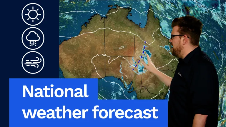
Those cold, frosty mornings will continue across south-eastern Australia on Thursday, with showers also continuing along much of our east coast as well. We’re also watching a fair bit of unsettled weather through central parts of the country, with a trough system there. That’s bringing showers and isolated thunderstorms through parts of Queensland and northern South Australia. But notice this high pressure system ridging right around the country, and that’s what’s going to cause settled conditions for many.
We’re also watching a weak front just brushing south-western parts of WA late in the day. That’ll bring some showers there, while Tasmania remains under the influence of the high. Another cold, frosty morning, but mostly sunny. Sorry, cold, frosty morning, but cold, sunny day. Moving now, so let’s have a look at all of that in more detail.
Firstly, in Queensland we’ve got two bits of precipitation. Firstly, those coastal showers along parts of the Queensland coast with those hit-and-miss showers. And then that weather system in far south-western parts of Queensland just bringing showers, patchy rain and isolated thunderstorms there. Pretty cool in the south-west with that cloud, rain and southerly winds, only getting into the mid to high teens out there. I’ll get out of the way here.
For south-eastern Queensland you can see temperatures also on the cool side there, with temperatures in the low 20s or up into the high teens through parts of the range around the Toowoomba area.
And then we’ve got low to mid 20s for the central coast and then high 20s into the north coast, and just reaching 30°C into the far northern areas. But inland areas staying pretty dry as well between the coastal showers and that rain in south-western Queensland. Brisbane looking at a few showers, particularly about the coast and bayside suburbs, 22°C.
Moving down into New South Wales, similar story. These coastal showers continuing right along the New South Wales coast during the day, maybe spreading inland to our ranges in some parts during the afternoon and evening. Cooler conditions, cold and frosty start through our inland areas.
You can see temperatures getting into the negatives around the Canberra area, and we may just sneak a shower or possible rumble into far north-western parts of the state later in the day. Showers and cooler on the east coast. Mid to high teens right across the state, maybe a little bit cooler here in the south-east. Sydney, a few showers and 18°C.
Canberra, a cold frosty start, -1°C and then getting to 13°C with partly cloudy skies.
Moving down into Victoria, another cold, frosty and foggy morning on the way for much of the state. I’ll get out of the way there. We’ve seen single figures down to 0°C and probably some areas below 0°C on Thursday morning, so our valleys through our eastern and central ranges will probably see another round of fog. But then that fog and frost should clear to a mostly sunny day across large parts of the state.
Staying cool though, temperatures in the low teens through southern areas and getting into the mid to high teens through northern areas. A cold start, but then a partly cloudy afternoon and 14°C in Melbourne.
Down in Tasmania, similar story with inland fog and frost during the morning hours, clearing to a partly cloudy day. Temperatures once again on the cool side, pretty much low teens across much of the state. Maybe just a few light showers on the north and western coasts as well during the day, but little if anything if they do occur. A cold, frosty start, but then a cool day and 13°C in Hobart.
Moving up into South Australia, northern areas will be impacted by that trough system, bringing showers, patchy rain and isolated thunderstorms. That’ll keep temperatures in the mid to high teens through there, also impacting our dirt roads for travellers out and about across the northern parts of the state, up towards the Lake Eyre region.
Further south, we’ve got temperatures in the mid to high teens with partly cloudy conditions. 15°C to 17°C the magic number for most of the state. Adelaide looking partly cloudy, 17°C.
Moving over into WA, pretty dry conditions for much of the state. The only wet weather will just be some showers coming with a trough and weak front in the south-western parts of the state as we move through the day, and that will extend slightly inland as we move towards Thursday night. Otherwise, temperatures in the high teens to low 20s through many areas, getting into the mid to high 20s as we get into northern parts of WA. Perth itself looking at a few late showers and 21°C. Pretty mild for winter.
Moving up into northern Australia, you can see that weather system there in southern parts of the NT. That’ll be moving out during the day, but we could see some showers and cloud lingering in south-eastern parts, but otherwise it should be further west. Partly cloudy and pretty dry through Alice.
Further north, dry and partly cloudy conditions. Mid to high 20s through central areas and, as usual, low 30s through northern parts of the NT on Thursday. Maybe just a few coastal showers in those easterlies around the far northern parts of Arnhem Land. Otherwise sunny conditions spreading right across the Kimberley as well, with hot, dry and sunny conditions. Darwin looking at partly cloudy and 32°C.
So a bit of weather on the way and, with the weekend approaching in coming days, you can always get the latest forecast and warnings via our website and app, and I’ll be here again tomorrow to give you Friday’s forecast.
Video current: 1:00 pm AEST Wednesday 08/07/26.