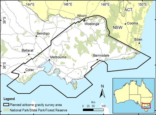
Airborne gravity surveys are being flown across southern and eastern Victoria to improve the accuracy of heights from Global Positioning System (GPS) and to advance our understanding of Victoria’s geology.
Commencing over the Gippsland and Hume regions and continuing throughout 2022, the airborne surveys are collaboration between the Surveyor-General Victoria, the Geological Survey of Victoria and Geoscience Australia.
Covering about 100,000 square kilometres the surveys will measure gravity to significantly improve the accuracy of heights from GPS across Victoria.
The data will also be used by geoscientists to further their understanding of southeast Australia’s geological ‘architecture’ and how it has evolved over time. This helps manage earth resources, infrastructure and natural hazards.
Experienced pilots, operating a DHC-6 Twin Otter and Cessna Caravan, fixed wing aircraft, will fly along planned routes with flight lines spaced about 500m-1km apart.
The aircraft will fly in public airspace about 150 metres above ground, increasing to 300 metres over built-up areas. The gravity sensing instruments do not emit any signals or impact people, animals or infrastructure in any way.


