Weather forecasts rely on many and various kinds of data, including temperature, humidity and wind data. For the first time, researchers including those at the University of Tokyo demonstrate that a long-theorized improvement to weather models by adding data on water isotopes in the atmosphere does in fact work. They showed that incorporating satellite measurements of water vapor isotopes into weather models improves forecasts of atmospheric conditions for up to five days, including better predictions of heavy rainfall in many regions.
Isotopes are alternate forms of atoms, where the number of neutrons is different to the number found in the typical atom. This means that isotopes are often heavier than their atomic counterparts and in the case of water, yields what is known as heavy water. It’s been known for some time that heavy water exists in the atmosphere in forms such as water with a heavy hydrogen isotope, or with a heavy oxygen isotope. It’s also known the way these evaporate and condense is a little different to normal too.
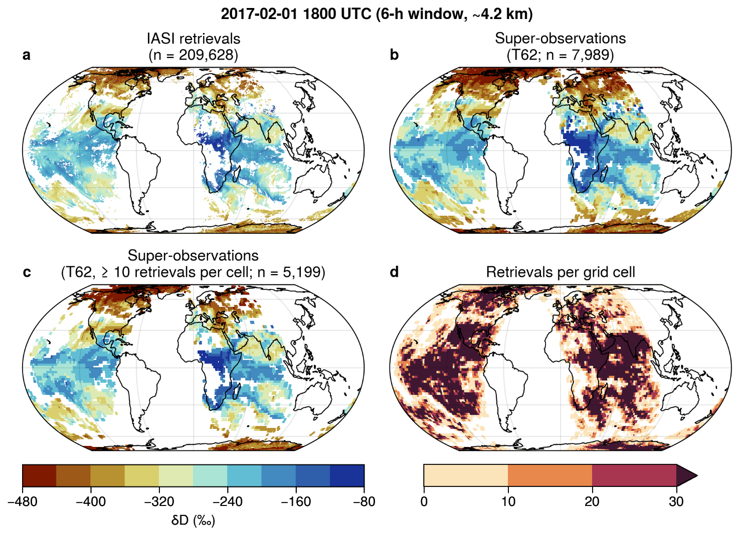
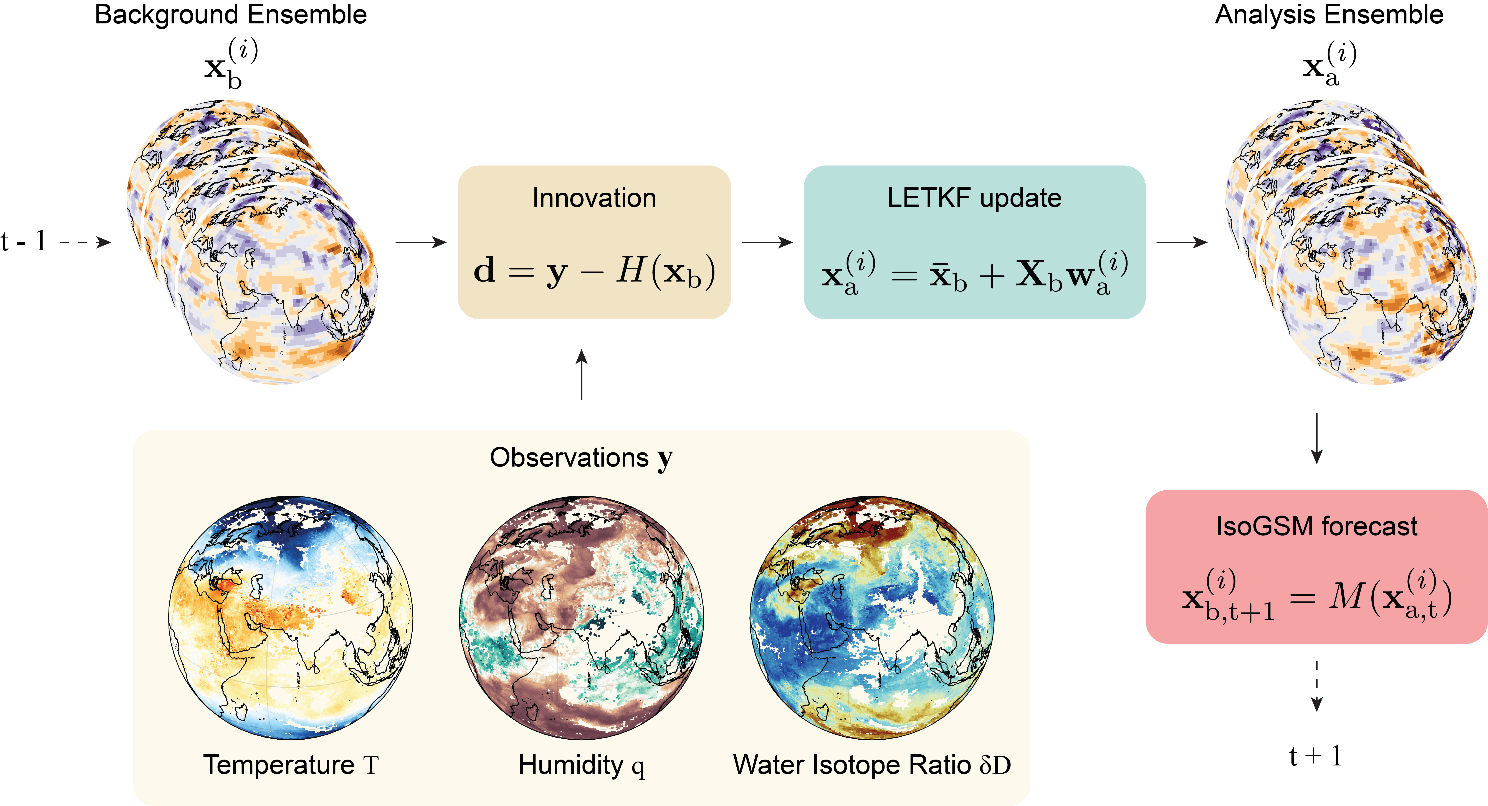
“Water isotopes occur naturally in very small amounts. Their relative abundance changes slightly during processes such as evaporation and condensation. By taking advantage of these changes, we can obtain information about where water came from and what happened to it along the way,” said Kinya Toride, a researcher with the National Oceanic and Atmospheric Administration in the U.S. and Institute of Industrial Science at the University of Tokyo. “In this study, we incorporated satellite observations of water vapor isotope ratios into a weather model, using a technique called data assimilation. We found that this additional information improved our estimates of basic atmospheric conditions, such as winds, temperature and water vapor, which in turn led to more accurate weather forecasts.”
Somewhat intuitively, as heavy water is slightly heavier, and it doesn’t evaporate quite as easily as normal water, it also precipitates more readily. These and some other subtle differences in behavior alter the distribution of water isotopes in the atmosphere. Although valuable, the observations alone don’t reveal which atmospheric variables, such as temperature, wind or humidity, are responsible for a particular isotope signal. To use this information, the researchers had to develop a way to disentangle isotope signals and translate them into atmospheric variables used in weather forecasting. Real-world observations also contain uncertainties and influences that are not yet fully understood, meaning that simply adding more data to models does not automatically produce better forecasts.
“This is the first study to show that water vapor isotope information can improve weather forecasts under conditions close to real operational forecasting. But it is not something that can be introduced overnight. We still have very little real-time isotope data, and today’s operational forecast models are not designed to use it,” said Professor Kei Yoshimura of the Institute of Industrial Science at the University of Tokyo. “Now that we’ve demonstrated clear benefits, especially when forecasting heavy rainfall, we have a strong reason to change that. Our long-term goal is to develop more accurate satellite observations of water vapor isotopes and integrate them into operational weather forecasting systems, so this additional layer of information can help make everyday forecasts more reliable.”
For isotope observations to become part of everyday weather forecasting, large amounts of data will need to be processed in real time, and operational weather prediction models will need to incorporate water isotopes. Given the ever-decreasing cost of launching satellites such as the kind that would be necessary, it’s increasingly likely that the kinds of data needed will soon be in the hands of researchers, climate modelers, and even weather presenters.