People are being asked to consider delaying their visit to Ku-ring-gai Chase, Berowra Valley and Georges River national parks, or visiting other parks, as authorities conduct multiple hazard reduction burns across Sydney’s north and west this weekend to reduce the bushfire risk.

National Parks and Wildlife Service (NPWS) Director Deon van Rensburg said hundreds of fire fighters from the NPWS and the Rural Fire Service (RFS) will be burning taking advantage of the mild conditions to make our summers safer.
“Starting Friday (28 August) a burn at Cumberland a 22 hectare burn in Scheyville National Park will be carried out in the Dormitory Hill area,” Mr van Rensburg said.
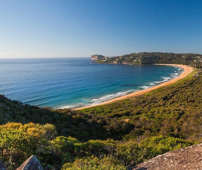
“The largest burn (263 hectares) is at West Head in Ku-ring-gai Chase National Park at the end of West Head Road on Saturday. This burn will help protect the Mackeral Beach community as well as the Basin camping and picnic area.
“Although this is a popular destination, members of the public are asked to consider visiting other parks or postpone their trip if possible,” Mr van Rensburg said.
The West Head lookout and surrounding bushland to the west of Mackeral Beach, Resolute Beach and West Head Beach on the western shores of Pittwater will be closed from Friday until Monday.
A second burn (7 hectares) will be near the end of Cottage Point Road, on the western side of Cottage Point Road and east of houses on Cowan Drive to protect the Cottage Point area and Ku-ring-gai Chase National Park.
People are reminded to that traffic management will be in place on Cottage Point Road to allow the filtering of vehicles near the operational area, and there may be some delays.
A hazard reduction burn in the Georges River National Park at Illawong will occur on Sunday where a 34 hectares burn will help protect the communities of Illawong and reduce the risk of wildfire to surrounding properties.
Motorists along Alfords Point Road are reminded to beware of potential smoke hazard and drive to conditions.
Public access to Georges River National Park within Illawong, including walk tracks, will be closed during the burning operations.
Additionally, two burns are starting this Sunday in Berowra Valley National Park around the Dural and Westleigh areas.
The Westleigh (Barkala) 48-hectare burn located in bushland between Quarter Sessions Road, Western Fire Trail, Elouera Road and Berowra Creek, Westleigh. Traffic management will be in place on the adjacent local roads and The Great North Walk will be closed within the burn area.
The second burn will occur at Dural (Pogson burn 75 hectares) and is located in bushland between Quarry Road, Dural, and Manor Road, Hornsby. Closure to the Quarry Fire Trail, Pogsons Trig Fire Trail, Fishponds Water Hole and Pyes Creek will be in place during the burn period.
The NPWS hazard reduction program for 2020 is focussed on essential burns to protect park neighbours, assets or significant habitat to ensure ongoing recovery of the wildlife impacted by the summer bushfires.
All burns across NSW will continue to be coordinated with the NSW Rural Fire Service (RFS) to ensure the impact on the community, including from smoke, are assessed at a regional level. Details on specific burns will be made available in advance on the Rural Fire Service website, ‘Fires Near Me’ app, and on NPWS Alerts website.
All hazard reduction burns over 50 hectares will be assessed by the NSW RFS in conjunction with NSW Health as required to ensure smoke impacts are minimised.
For health information relating to smoke from bush fires and hazard reduction burning, visit NSW Health or the Asthma Foundation.
For up to date information on these, and other, planned hazard reduction activities, visit the Rural Fire Service.


