Dugongs are coastal marine mammals of high conservation and cultural value, particularly for Aboriginal and Torres Strait Islander peoples. However, these gentle underwater giants are subject to a range of human threats including entanglement, collisions with boats and the decline of important habitats such as seagrass meadows. This has led them to be listed as Vulnerable on the International Union of the Conservation of Nature’s (IUCN) Red List of Threatened Species.
The Great Barrier Reef supports one of the world’s largest dugong populations, which is one of the key reasons for the Reef’s listing as a World Heritage Area.
Surveying and counting these elusive marine mammals across the vast breadth of the Reef is no easy task. With funding from the partnership between the Australian Government’s Reef Trust and the Great Barrier Reef Foundation, one team is tackling this project head on.
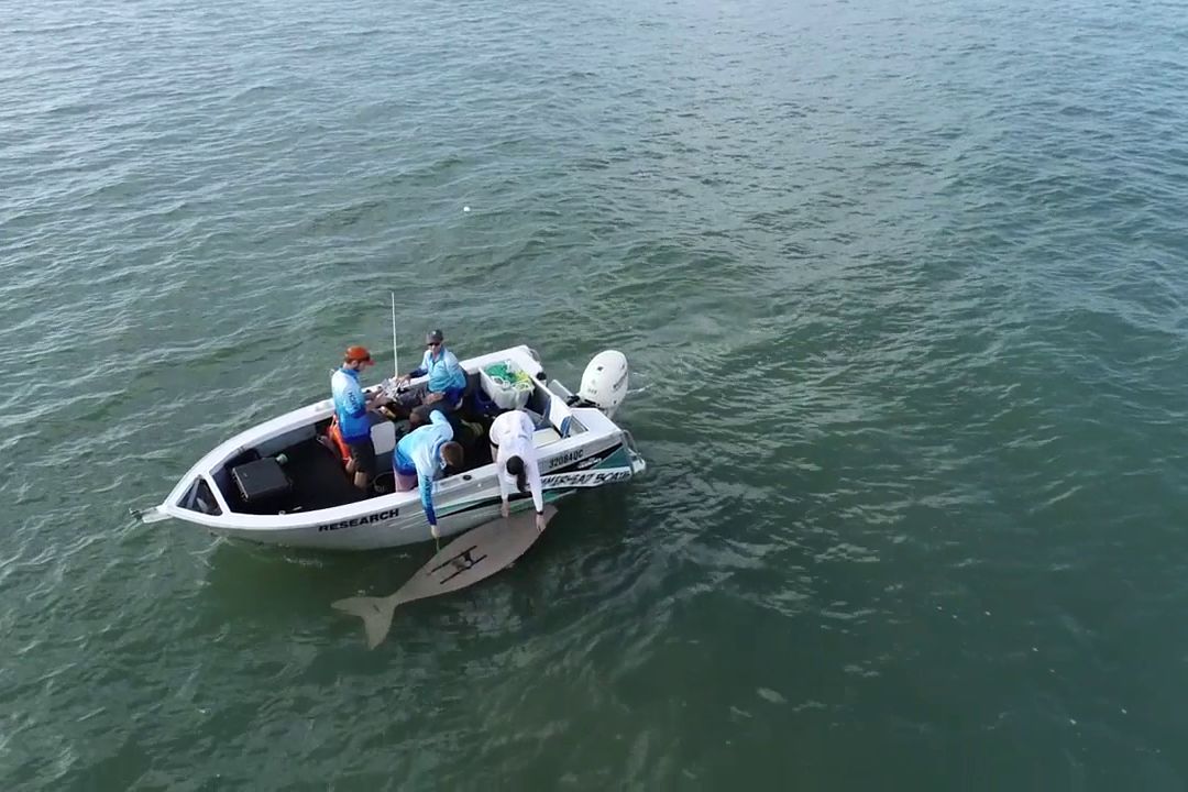
The team carries out drone survey practice with a dugong cutout. Credit: Cristophe Cleguer.
#A need for more surveys
Since the 1980s, aerial surveys have provided valuable information on dugong distribution and abundance in many parts of Australia, including the Reef. These surveys have occurred at the same time of year, every five years. The data collected is vital for researchers and conservationists, who use it to enhance the management and protection of the species.
Observer aerial surveys of dugongs along the southern Great Barrier Reef, which runs from Bundaberg to Cooktown, were last conducted in 2016, and the northern part of the Reef, from Cooktown to Cape York, in 2018-2019.
In 2020, the Reef 2050 Integrated Monitoring and Reporting Program (RIMREP) identified that increased dugong survey efforts were required, particularly in the southern Reef. Importantly, the whole east coast of Queensland—which spans the entire Great Barrier Reef and vital dugong habitats south of the Reef including Hervey Bay and Moreton Bay—has never been surveyed in one cohesive monitoring project, until now.
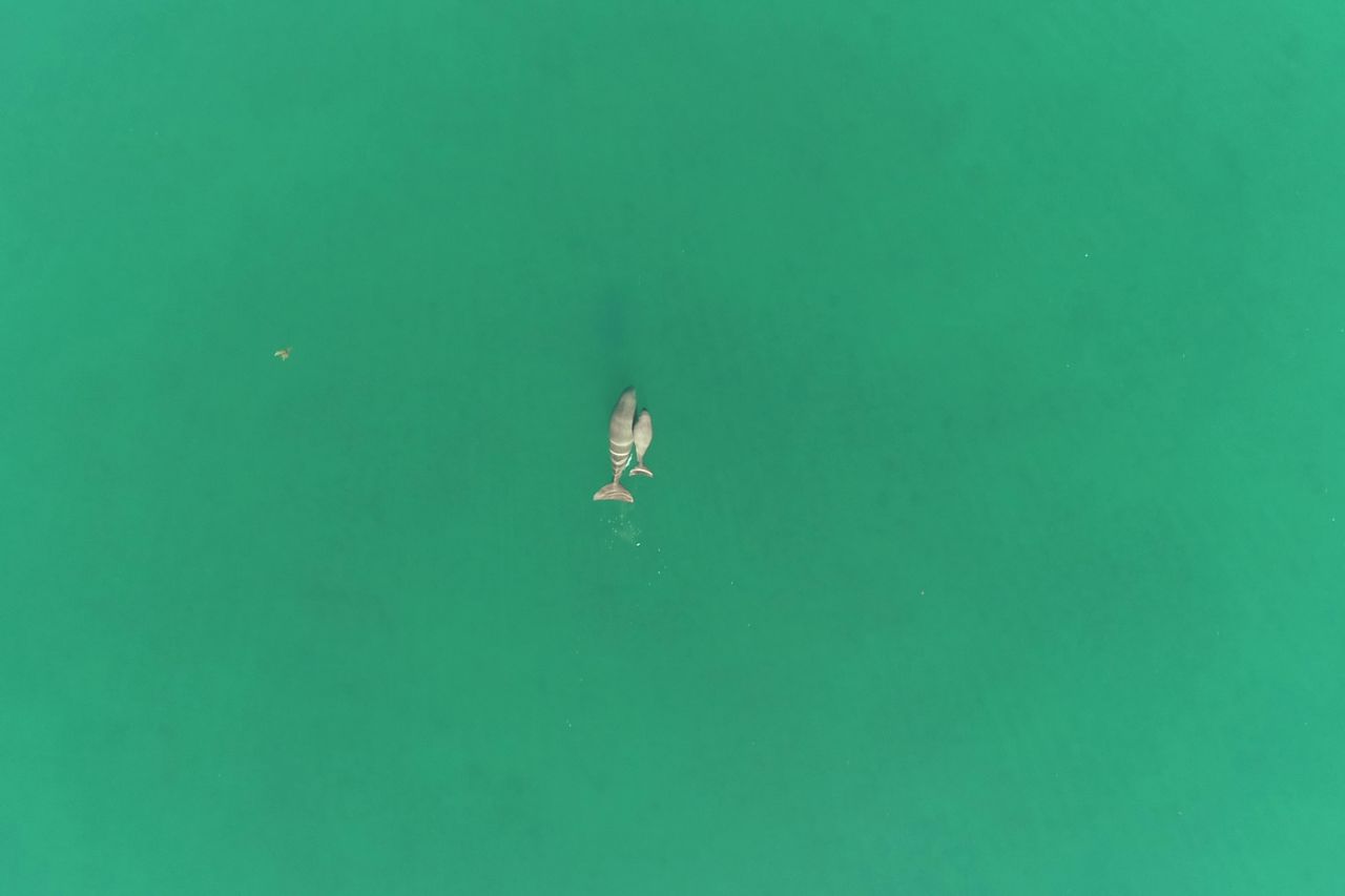
A mother dugong and her calf spotted from above. Credit: Cristophe Cleguer.
#Harnessing innovative technology
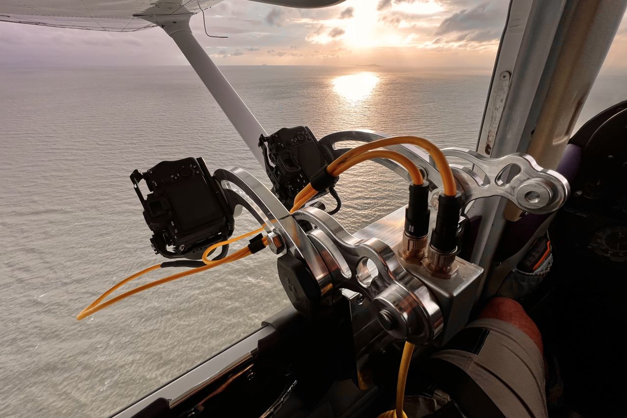
James Cook University is leading an innovative project with the support of a consortium of partners to transition to new technologies to monitor dugongs on the Reef. They are harnessing a combination of methods including custom-designed camera systems fitted onboard manned survey aircrafts, drones and machine learning-based image analysis. During these surveys, researchers also capture opportunistic data on turtles and other large marine animals, so they can share that information with other teams across RIMREP.
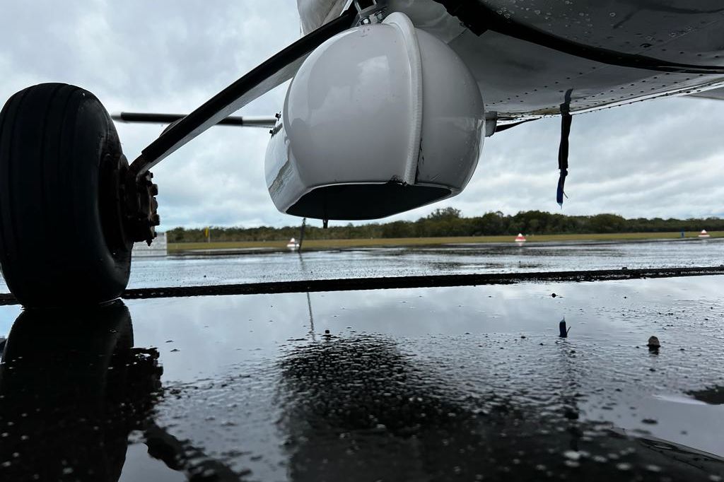
The project is led by Dr Christophe Cleguer and his dedicated team. This year, the team has spent over 25 days out surveying the central and southern regions. During the two to three-hour aerial surveys, the plane is flown in parallel lines along the coastline, with observers looking out for dugongs and other animals, while the cameras attached to the bottom of the plane record photos.
Surveys are conducted at low altitudes and conditions inside the plane can be quite challenging.
“On good weather days, we would fly for several hours before dedicating additional hours to data transcription. In such conditions, it is crucial to assemble a team of enthusiastic and resilient individuals with a positive spirit,” Dr Cleguersaid.
Drones are now also being trialed, as they provide several benefits compared with manned flight surveys.
“They eliminate the risk of human injury or fatalities during surveys, reduce the carbon footprint of aerial surveys, improve accuracy in flight paths and, hopefully in the future, will lower the operational costs of conducting large-scale surveys,” he said.
Given the current challenges involved in the continuous monitoring of this species across the Reef and its coastlines, the innovation of survey techniques will help provide better estimates of dugong abundance, as well as habitat mapping.
An important part of this survey is engagement with Traditional Owner groups across the Queensland coast. Through this partnership, the team is sharing and discussing survey objectives, methods and results, which will help Traditional Owners inform ongoing sea country management.
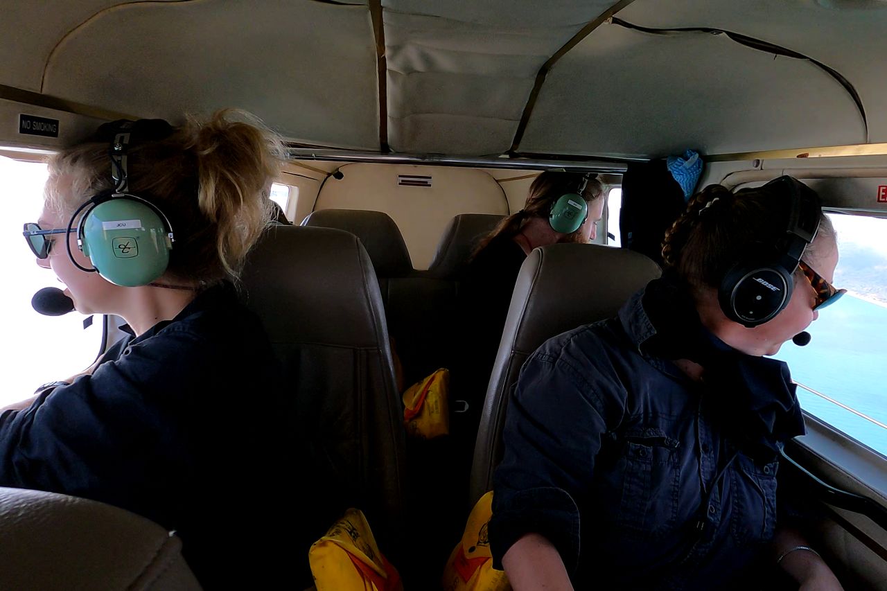
Observers carefully scour the water below for dugongs. Credit: Cristophe Cleguer.
#Artificial intelligence helps process survey images
The use of artificial intelligence (AI) is crucial in making large-scale imagery surveys cost-effective. One of the current bottlenecks of imagery surveys across large areas is the huge amount of data collected. To make the imagery survey cost-effective, it is crucial to automate and fast-track the review of images.
“At the moment, the team is manually reviewing hundreds of thousands of images to help further improve AI models to automatically detect dugongs. The animals spotted in the imagery will also be compared to the sightings made by the observers in the plane to identify any difference between the two approaches,” explained Dr Cleguer.
In 2022, the team gathered images spanning the southern section of the Reef (from Mission Beach to Bundaberg), as well as over Hervey Bay and Moreton Bay. In total, they amassed nearly 2 million images, amounting to 13 terabytes of data.
“To the best of my knowledge, this represents the largest marine wildlife aerial imagery survey ever conducted in Australia. The only viable method for processing such an immense volume of data and efficiently detecting dugongs, as well as estimating their abundance and distribution within reasonable timeframes, is through the implementation of AI. So we are presently evaluating the performance of existing AI systems in processing our data and identifying areas where improvements can be made to ensure the competitiveness of this approach,” he said.
Along with using machine learning techniques to help process the huge amount of data collected in the southern Reef survey, the team will now focus on the design of the northern survey later this year.
“Our primary aspiration is to encounter favourable weather conditions with minimal wind and rain. Surveying the northern Reef presents specific challenges as it is significantly more remote than the southern section, and the weather can be unpredictable. And of course, we are always hopeful to observe many dugongs during our survey!”
By incorporating new modes of technology into surveillance methods, this project is filling a key knowledge gap on these iconic animals, and will also set a new benchmark, using innovation and collaboration as guiding principles for the design of future dugong monitoring projects.


