The NSW National Parks and Wildlife Service (NPWS) will conduct a hazard reduction burn in Brisbane Water National Park starting Thursday 3 August.
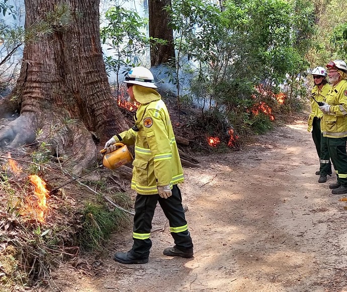
The 375-hectare burn will reduce naturally accumulated fuel loads in the park to protect nearby residential areas in Kariong, Woy Woy Bay, Phegans Bay and Horsfield Bay from future bushfires.
The burn will be just south of Kariong and is scheduled to start at 10am on Thursday, with mop up and patrol continuing on Friday and over the weekend.
Tracks will be closed on the Great North Walk between Wondabyne train station and Old Pacific Highway at Mooney Mooney Creek, and between Wondabyne train station and Tommos Loop fire trail.
Girrakool Picnic Area including Piles Creek Loop walking track and Girrakool Loop walking track will also be closed during the burn. Once the area is deemed safe, the picnic area, tracks and trails will be reopened.
Smoke may be visible from the M1 Motorway, Central Coast Highway, Woy Woy Road and residential areas of Kariong, Calga, Point Clare, Tascott, Koolewong, Woy Woy Bay, Phegans Bay, Horsfield Bay and Woy Woy.
People vulnerable to smoke are encouraged to stay indoors and keep doors and windows closed to reduce exposure.
Hazard reduction burns are essential to reduce bushfire fuel loads to help protect parks, neighbours and communities from future bushfires.
This burn is one of many hazard reduction operations undertaken by National Parks and Wildlife Service each year, many with assistance from the Rural Fire Service and Fire and Rescue NSW.
All burns around the state are coordinated with the NSW Rural Fire Service to ensure the impact on the community is assessed at a regional level.


