The NSW National Parks and Wildlife Service (NPWS) is conducting hazard reduction burns near Mudgee and Lithgow over the next few days, weather permitting.
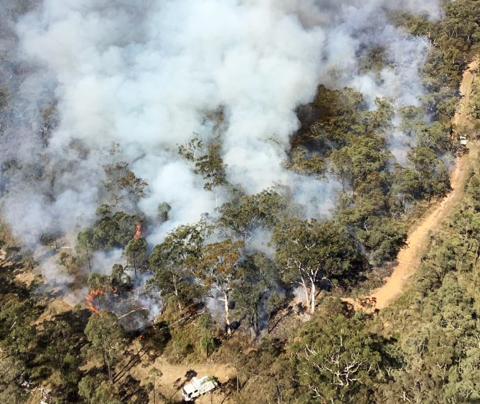
NPWS Mudgee Area Manager Lisa Menke said burns began Thursday in Durridgere State Conservation Area and Goulburn River National Park. A further hazard reduction is planned in Capertee National Park for Friday (28/4).
The three burns will treat approximately 1,600 hectares.
Ms Menke said the hazard reduction operation was taking advantage of favourable forecast weather to reduce fuel loads in the area and to promote biodiversity benefits.
“The weather over the next couple of days is perfect for burning and is being done ahead of a solid forecast for rain on the weekend,” Ms Menke said.
The Durridgere SCA hazard reduction is in the Turill area north of Summerhill Road. Turill is approximately 60 km north-east of Mudgee.
The Munmurra South hazard reduction is approximately 12 km north of Wollar and is in Goulburn River National Park.
The East Wallaby hazard reduction is within Capertee National Park near Glen Alice, with Port Macquarie Road forming one of the containment lines.
The burns are expected to continue until Saturday 29 April when wet weather is forecast to affect all fire grounds.
Smoke will be visible near Turill from Summerhill, Ulan and Durridgere roads. It will also be visible from Mogo Road near Wollar.
On Saturday, smoke will be visible in the Capertee Valley. Motorists are advised to drive to conditions.
Anyone vulnerable to smoke is encouraged to remain indoors and keep doors and windows closed to reduce any possible exposure.
Visitors should check NPWS Alerts for up-to-date information on closures during the hazard reduction operations.


