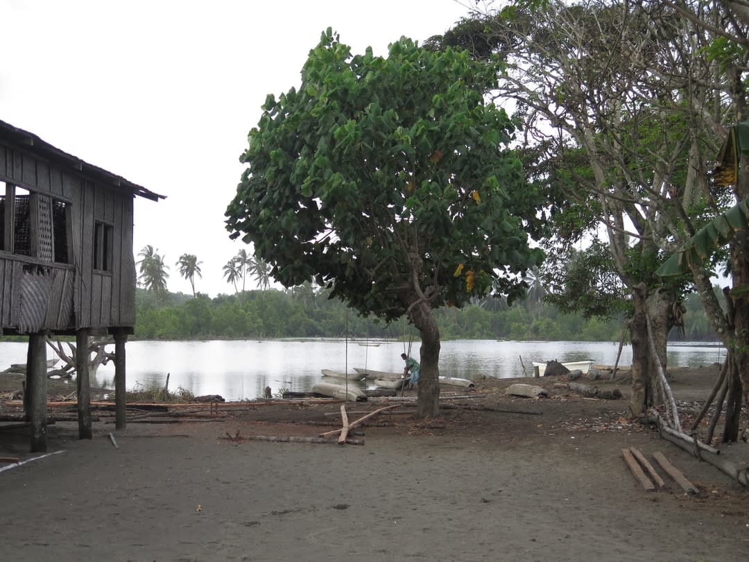
In late 2015, I arrived for the second time at a place called Orokolo Bay on Papua New Guinea’s south coast. The bay is a long grey-black beach, densely forested with hibiscus and coconut trees. As we approached by dinghy from the east, clusters of houses could be glimpsed fleetingly among the bush.
I had arrived with colleagues from PNG’s National Museum and Art Gallery to commence an archaeological project in partnership with two village communities, called Larihairu and Kaivakovu. Working alongside local experts in oral tradition, I hoped to use Western archaeological techniques – surveys, excavations, carbon dating and analyses of material culture – to unravel aspects of the human history of Papua New Guinea’s south coast.
But in the weeks that followed, I became aware that we were covering old ground. Our archaeological surveys were not revealing previously unknown archaeological sites. Rather, locals introduced us to their ancestral places.
Many of these places bore surface traces of their ancestors’ lives, such as scatters of earthenware pottery sherds and shell middens, making it obvious how and why people were aware of them. To my surprise, though, the locals also had an intimate knowledge of what lay beneath the ground. Through the daily activities of cultivating crops (called “gardening” in the Pacific) and building structures, people in Orokolo Bay have been continually digging up and interpreting evidence of their ancestral past for generations.
This kind of uniquely Indigenous archaeology – conducted as part of daily life – continually breathes life into and sustains local oral traditions. The locals told us about how these cultural deposits, along with distinctive layers of dark sediment in the ground, spoke of the actions of their ancestors in recent generations, and of a time when the Earth itself was formed in the cosmological past. All this gave me a new appreciation for oral traditions of Indigenous peoples, and how they may incorporate not just memories, but also physical evidence of the past.

In Orokolo Bay and other parts of the south coast of PNG, people are in the business of working with the earth. When locals want to establish a garden, they find a location where the sandy soil is well-drained and fertile. Whether the garden is new or being remade, areas of vegetation and undergrowth are cut down and burned. Then holes are dug to plant the varied and colourful crops that grow so abundantly in the tropics, such as taro, yams, pineapple, sweet potato, and corn.
In this process, the ground surface is laid bare and the subsurface exposed. Activities such as house-building have similar effects – surface vegetation is cleared, and foundation posts are dug deep into the ground.
Today, the people of Orokolo Bay build their gardens in cleared forest patches a couple of kilometres inland – an area that was once situated on the coastline. Throughout the human history of coastal occupation in this part of the world, beaches have been growing rapidly southwards at a rate of about three metres per year as river sediments pile up and extend the coast.
Previous archaeological studies in the region have shown that people moved their villages with the changing coastline, preferring to live near the sea to access marine food and trade routes. For many years, the old inland sites have been overgrown with dense tropical forest. But within the past five generations, people have cleared areas of forest to establish gardens.
On a Wednesday morning in September 2020, our archaeological team had just finished the technical drawings of a site we had excavated. Kaivakovu village elders – who had been busy with community meetings – arrived to take us on a survey of their ancestral sites. Each at least 40 years my senior, the elders took off at a startling pace; they threaded a trail through numerous named and storied places situated on ancient beach plains and hillsides.
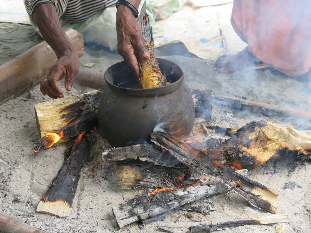
Wherever we saw evidence of recent gardening activity, there were physical remains of the past spilling out of the ground. At one site (called Maivipi), one of the elders had just dug scores of banana plants into the ground. Each plant was now surrounded by dozens of recently disturbed pottery sherds. At another site, we saw once-buried shell and animal bone strewn across a large communal garden area.

For locals, these materials signify two things.
The pottery sherds are reminders of close social relationships with Motu people who live approximately 400km to the east. Up until the mid-1950s, the Motu (from today’s Port Moresby region) would annually sail into villages such as those in Orokolo Bay, bringing with them tens of thousands of earthenware pots. They would return to their families months later with tonnes of food in the form of sago palm starch, along with hardwood logs to make new canoe hulls.
Second, the remains of pots and food are reminders of the large and thriving villages that the locals’ forebears established. Women used their pots to cook food for daily sustenance and for communal feasts. Fragments of the pots are reminders of work and life in the village, and their presence indicates where centres of domestic activity might have been located.
The significance of Popo
Of the ancient villages, a 1.3km-long place called Popo looms large in local and regional oral traditions.
Popo is a legendary migration site for Orokolo Bay residents, and for many other clan and village groups living in coastal locations up to 125km farther to the east. According to local oral traditions, the village was inhabited by ancestors between 16 and seven generations ago (Western dating techniques put it at 700-200 years ago). Clan-based social structures, longhouse buildings (15-metre-tall cathedral-like houses), and ceremonies were all developed there.
Locals recount that the site was divided into estates or “suburbs” that belonged to the different clans that today occupy the coastal village communities. Popo is also a cosmological origin place; their stories tell how the entire world was made there.
Interestingly, there’s a strong correlation between the intensiveness of agricultural activity in various spots throughout Popo and the perceived antiquity of those sites. Estates where more land has been cleared and where people regularly encounter pottery sherds or shell middens are generally perceived to be more ancient. The remains have also helped locals to determine where the centre of the village or the longhouse might have been located.
This process can be seen across the globe. Archaeological remains are most often found incidentally during land clearance or excavation for development. Where there are concentrations of sites or finds, we tend to view these places as especially ancient.
During our excavations at clan suburbs called Miruka and Koavaipi, we found thin layers of jet-black sand. According to Western geomorphology, these are layers of iron-rich magnetite sand – sediment that was transported by rivers from PNG’s volcanic mountains into the Coral Sea.
But locals see their ancestors’ actions in the sand. Paul Mahiro – son of the famed Orokolo Bay historian Morea Pekoro – told me that the black sand was laid by his ancestors when they were creating the land. Paul said that two ancestor beings travelled from the west in a magical sky-borne canoe sometime in the deep, cosmological past.
“In their hand, they had a … black sand,” he recounts, which they left at Popo and many other nearby coastal locations. When gardeners unearth these thin layers, they are reminded of their ancestors’ travels and actions.
Science doesn’t always agree
Of course, Western scientific and local ways of reading the past don’t always agree. For example, our excavations and radiocarbon dating program provide a different order of suburb establishment at Popo than the oral traditions. Some of the youngest suburbs according to oral tradition are the oldest in our radiocarbon sequence.
Likewise, archaeologically speaking, the black sand layers formed in two relatively recent events – one dating to about 650 years ago, and the other just before 200 years ago.
These temporal contradictions don’t necessarily cause conflict. One night, while socialising in a house in Larihairu village, a younger community member asked me what I knew of the past. I replied that, as an archaeologist, I hoped to investigate human history using the materials people left behind. He replied: “You only know about the human story, but we know about the mythical beings and spiritual beings.”
I get the sense that Western scientific chronologies don’t pose an existential threat to the mythical and spiritual pasts of Orokolo Bay. Within the oral traditions themselves there are already overlapping and interwoven chronologies, each of which serves a different purpose. Popo is understood simultaneously as a migration site occupied between 16 and seven generations ago, and as a timeless origin place.
Carbon dates provide another parallel chronology, which can help place the site in broader context and enable us to compare the history of places along PNG’s south coast. They can also be used by locals to serve their own purposes – for example, to argue for government protection of certain sites from mineral extraction or foresting.
Implications for traditional knowledge
The Orokolo Bay example also has crucial implications for how we understand oral traditional knowledge. Recently, there has been a great deal of interest in millennia-old Indigenous oral traditions from North America and Australia that record details of environmental changes and interactions with long-extinct animals.
Aboriginal oral traditions from across coastal Australia describe a time in which sea levels rose dramatically, which Western science dates to a time from 13,000 to 7000 years ago. Even more remarkably, stories told by Australian Aboriginal Gunditjmara people may describe a series of eruptions that took place 37,000 years ago.
Those who study oral traditions often refer to them as “memories”. The word suggests that experiential information was passed down from generation to generation by word of mouth alone.
What if oral traditions are not just handed-down stories? What if they incorporate First Peoples knowledge of the archaeological and geographical features they dwell among?
What if oral traditions are not just handed-down stories? What if they incorporate First Peoples knowledge of the archaeological and geographical features they dwell among?
In Orokolo Bay, people read the ancestral past in their landscapes. They identify stratigraphic features, and relate these to the stories told to them by their elders. They observe concentrations of pottery, and weave their interpretations of old village sites into the oral traditions their families curate. These interactions hint that Indigenous archaeologies and other forms of landscape knowledge are crucial to how oral traditions are sustained and maintained across generations.
It’s time to reconsider the remarkable (and complex) ways in which First Peoples record and reconstruct the past. I think we’ll continue to be amazed by their oral traditional technologies, and what they record.
Featuring
Chris Urwin
Research Fellow at Monash Indigenous Studies Centre
Dr Chris Urwin is conducting archaeological and museums-based research in partnership with First Peoples communities to investigate their remarkable landscapes in Australia and Papua New Guinea (PNG). He completed his PhD in 2019, for which he worked with two villages in Orokolo Bay (PNG) to establish radiocarbon chronologies for their ancestral sites, alongside a programme to document local oral traditions. This research has helped improve our understanding of the history of exchange and social change on PNG’s south coast.
