Some of the most significant Aboriginal cultural heritage places in Australia are located along the Murray River, including Ancestral resting places, middens, and culturally modified (scarred) trees.
Devastatingly, more than 5,500 registered places of cultural significance across the Parks Victoria estate were affected by the torrential rains of the October 2022 floods.
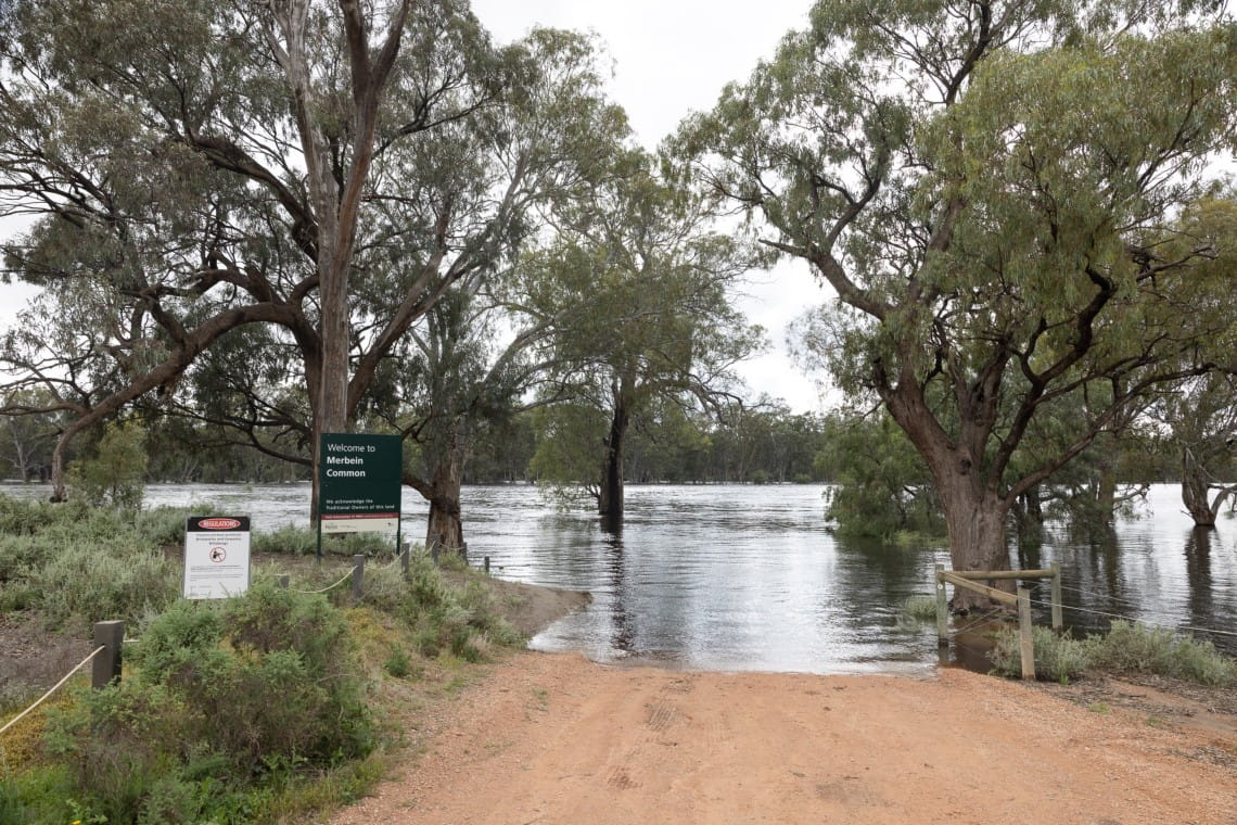
Merbein Common (above) on the Country of the First Peoples of the Millewa-Mallee, Mildura, November 2022 © Parks Victoria
In the weeks following the catastrophic weather event, a small, dedicated Aboriginal Heritage Recovery Team (AHRT) worked around the clock to assess the impacts and ensure recovery efforts did not cause further harm.
Coming to terms with the scale of the loss was one of many challenges faced by the AHRT, according to Josh Berick who worked as one of two coordinators of the recovery project.
While extreme weather events often lead to the exposure of unregistered Aboriginal places which can be added to the heritage register, Josh says it also increases the likelihood for harm to occur.
“It’s every Australian’s responsibility to want to protect these places because it’s everyone’s history. We should all want to benefit from the knowledge we can get by respecting these places and want to protect them from being destroyed.”
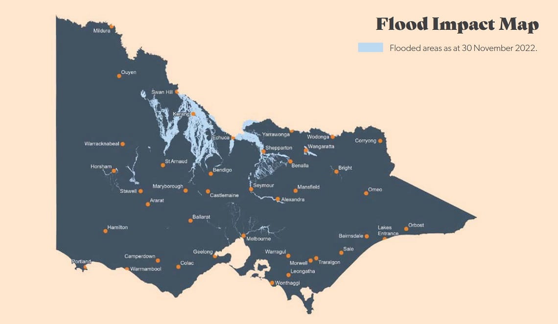
This map provided by the SES shows the extent of the flooding across Victoria as of 30 November 2022.
There are almost 14,000 Aboriginal cultural places registered on the Parks Victoria estate, as shown in the Girtgan Kurtba Ngulmbiu Gway-un Aboriginal Cultural Heritage Plan Performance Report 2021-22, but this is only the tip of the iceberg.
Less than 2,350 places have accurate location and management details on the Aboriginal Cultural Heritage Register and Information System and less than one percent of the Parks Victoria estate has been formally surveyed for Aboriginal cultural values.
With the support of $1.5 million from the Victorian state government, Parks Victoria planned and is delivering post event heritage evaluations (PEHE) at key locations with significant Aboriginal heritage values.
Heritage evaluations were commissioned within Hattah Kulkyne National Park, Gunbower National Park, Murray Kulkyne Park, Nyah Vinifera Park, Mt Alexander Regional Park, and a segment of the proposed Murray River Park (Belsar Island).
Planning for PEHE is in its final stages for various additional locations, such as Chiltern-Mt Pilot National Park, Dharnya Centre, Barmah National Park, Lake Lyndger Wildlife Reserve, Kings Billabong Park, Murray – Sunset National Park, River Murray Reserve – Merebin Cutting Carpark, Little Desert National Park, Coliban River Scenic Reserve, Tragowel Swamp Nature Conservation Reserve, Hepburn Regional Park, Plenty Gorge Park, Kooyoora State Park, Great Otway National Park and Grampians National Park and to be completed by the end of June 2024.
These efforts underscore Parks Victoria’s commitment to protect and engage with Traditional Owners to understand the impact across a diverse range of cultural landscapes.
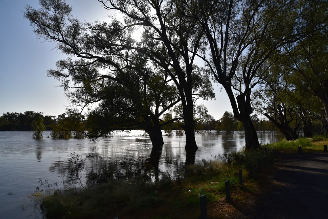
Floodwater in the proposed Murray River Park Apex Bend October 2022 © Patrick Pigott
Jolene Goulton, Fire and Emergency Recovery Manager said, “despite the enormous effects of the flood event, we delivered some incredible innovations to improve recovery outcomes, timeframes, and communication.”
“These include the development and rollout of a Recovery App to collect impact assessment data and images, where just over 12 months ago we were entering data into excel spreadsheets.”
“The development of the state-wide program of post flood heritage evaluations is being delivered in partnership with Emergency Recovery Victoria (ERV) and Traditional Owners to understand impacts to cultural heritage at Mt Alexander Regional Park, Hattah National Park, Murray Kulkyne Park, Nyah Vinifera Park, Plenty Gorge Park, Murray River Reserve, Gunbower National Park and a range of metro parks,” Jolene said.
“By developing an online data management system to replace excel spreadsheets, we can produce rapid spatial assessment of registered Aboriginal heritage places and disaster impacts to inform heritage protection pathways and recovery timeframes.”
Traditional Owners working on self-determined recovery
With grant funding through the Department of Energy, Environment and Climate Action (DEECA), 15 Traditional Owner groups can actively decide on their own priorities for flood recovery. This supports public land recovery while also acknowledging and supporting the important role Traditional Owners have in land management activities.
The need to support Traditional Owner-led recovery activities on public land could continue for several years depending on the support required from Traditional Owner groups and the effects of flooding on culturally significant sites.


