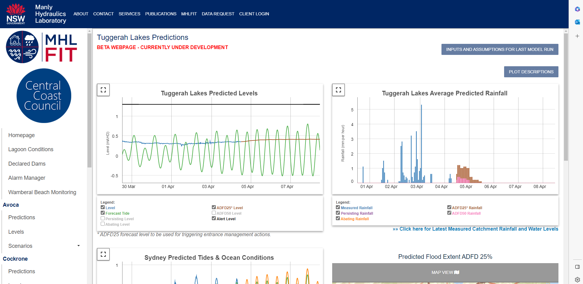
Council actively monitors the condition of Tuggerah lakes and other coastal lagoons.
Here are answers to our community’s recent questions:
What’s the current status of The Entrance channel?
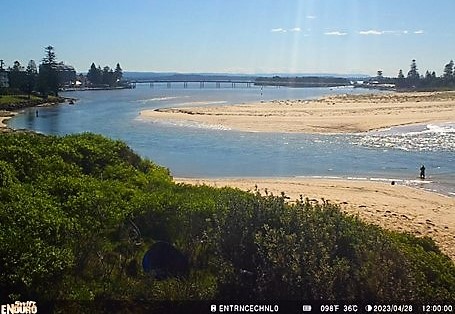
Through active monitoring of aerial and satellite imagery and the tidal gauge at The Entrance, the condition of the channel currently remains open with water flowing between the estuary and the ocean – however it is classified as heavily constricted. As at 28 April 2023, forecast rainfall from the Bureau of Meteorology indicates that the level of Tuggerah Lakes is not likely to increase beyond the normal range into the recognised flood range, and therefore does not require further intervention at this stage.
A fully closed channel is a different classification altogether, which would trigger a different response to what is required with the channels current condition.
The channel being heavily constricted does not warrant immediate action but does allow for intervention by Council to manage the berm in the event that a flood of 1.3m or higher is predicted through our Manly Hydraulics Laboratory Flood Intelligence Tool (MHLFIT). There is currently no indication of the lake height reaching or exceeding 1.3m, or even the minor flood level of 0.9m and therefore berm intervention is not required at this time.
Photo caption: The following image of The Entrance Channel was taken on 12:00 PM Friday 28 April 2023, via one of our remote monitoring cameras and shows the flow of water from the estuary to the ocean.
Are there benefits of a constricted channel for the estuary?
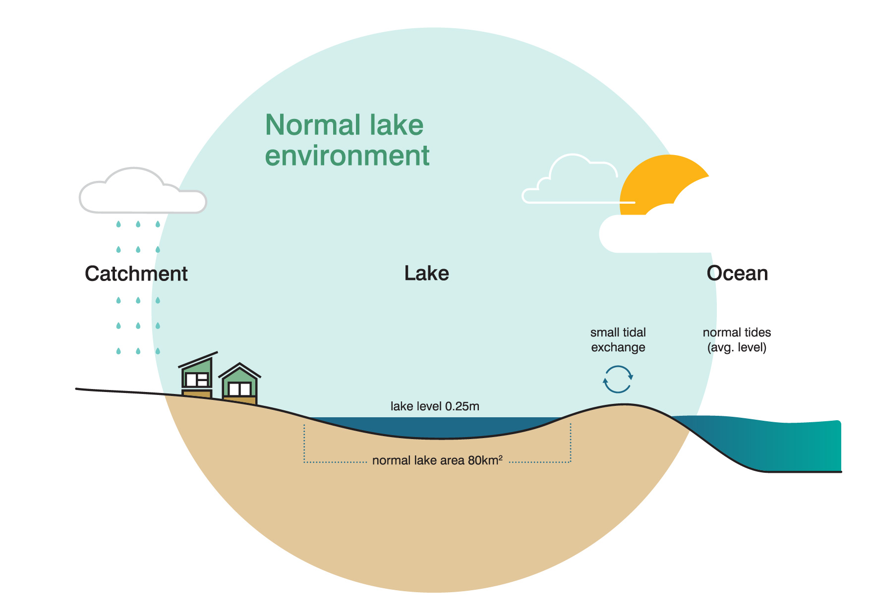
There’s a natural movement in the height of the water within Tuggerah Lakes which supports the health of the estuary.
Estuaries such as Tuggerah Lakes with intermittent entrances are extremely dynamic and changes to channel conditions are a natural process. The recent constriction of the channel can be attributed to mild wave conditions and lower rainfall in the catchment.
When The Entrance channel is in a more constricted state, water levels in Tuggerah Lakes tend to be moderately higher on average. This natural variation in water levels is an important process which can improve water quality and amenity as it allows the water level to flow across the fringing wetland habitats which in turn mixes the water near shorelines (which is more stagnant and prone to stormwater pollution when lake levels are low) with the greater lake basin water. Fluctuations in lake levels also help to free and lift wrack that can get trapped near the shoreline, and place it in areas where it can aerobically break down (such as saltmarshes, fringing wetlands, and foreshore reserve areas).
View the timelapse video that shows the dynamic movement of The Entrance channel over the last few months:
How does Council monitor Tuggerah Lakes and The Entrance?
Council actively monitors the condition of Tuggerah lakes and other coastal lagoons including The Entrance channel and uses the MHLFIT which helps guide when Council intervention is required in order to mitigate the risk of flooding.
Our coastal lagoons, lagoons are opened when water levels reach a trigger level, and when the lagoons are closed. This is a similar approach to that taken in other coastal local government areas.
For Tuggerah Lakes, our procedure is more unique and complex as the MHL FIT uses predicted rainfall data to forecast potential lake levels before they occur, which allows Council to intervene in management of The Entrance Channel (for example through berm management) at an earlier point in the process. Unlike the other coastal lagoons, Council may also intervene in its management of the channel before it is closed.
Council also uses a gauge at The Entrance Bridge to provide a quantifiable measure of the influence of ocean tides on the estuary, and subsequently how constricted the channel is. So channel constriction is not just measured through visual observation.
Council also has an Interim Entrance Management Procedure to guide actions depending on the state of the channel, and projected lake levels and is currently working on the development of an Entrance Management Strategy through the Tuggerah Lakes Coastal Management Program.
That the channel is heavily constricted does not warrant immediate action, but does allow for intervention by Council to manage the berm in the event that a flood of 1.3m or higher is predicted through our MHLFIT tool.
Council’s procedure for managing The Entrance Channel can be found within the Tuggerah Lakes Entrance Management Study.
Figure Caption: A previous image of Council’s MHL FIT for Tuggerah Lakes, which considers various rainfall forecasts 4 days in advance, current lake levels, tidal forecasts, and ocean anomalies (for example as a result of an East Coast Low) to predict lake levels and allow early channel intervention in accordance with our Interim Entrance Channel Management Procedure.
