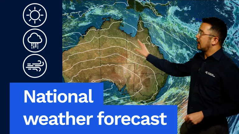
First, let’s have a look at the synoptic map. And we can see a cold front clearing away during the morning from the south-east of the country. Showers will ease initially across parts of southern Victoria and Tasmania, but they will redevelop and become more widespread into the afternoon. That’s as another trough approaches from the south-west with more gusty winds to follow. But that colder air is finally moving away from the country as you head towards the weekend. Showers are also expected across the south-east Queensland coast and about parts of the Top End coast, but otherwise we are being dominated by a very broad ridge of high pressure. That’s leading to mostly clear skies all the way from the east coast, and out towards Western Australia.
So now, a state by state look, starting off with Queensland. We are expecting patchy morning fog across eastern areas. Not quite as likely across Brisbane and the south-east, particularly given how foggy it was on Thursday morning. It will be cold inland, but then a fine and sunny day to follow with colder southerly winds pushing through. Really only expecting showers about the south-east coast, generally south of about K’gari, nothing more than a millimetre or so is expected in the gauges. So for Brisbane, a partly cloudy day, slight chance of a light shower, 22 °C. Sunny and warm up in Cairns with a top of 27 °C.
Now to New South Wales. With a cold start, we are expecting widespread frost inland, patchy morning fog across the north-eastern ranges, also foggy to start across the South West Slopes. We are expecting a mostly sunny day across the state, but a bit of cloud building into the afternoon across the Riverina and the south-west of the state. Sunny also along the coast. A cold start for some though, we could see some areas of frost across western Sydney to start, but then bouncing back to 17 °C. A little bit cooler as well.
And Canberra, a very cold start, -4 °C, then a sunny top of 12 °C to follow into the afternoon.
Now to Victoria. We are expecting to see some frost across northern parts of the state to start with, and some fog across the north-east. But north of the Divide, a sunny morning, then cloud will build into the afternoon. A bit of a different story though south of the Divide. We are expecting cloudy conditions and showers from the morning, including across Melbourne’s south-eastern suburbs, out towards the Yarra Ranges. Then into the afternoon, as that trough approaches, showers become more widespread, particularly about the south-west coast. Temperatures close to average or slightly below average for this time of year. For Melbourne, a couple of showers, cloudy though, those showers are most likely through the south-eastern and eastern suburbs, going for a top of 14 °C. Mildura, sunny to start, but then clouding up into the afternoon with a top of 15 °C.
Now to Tasmania. We are expecting to see a few showers about the west. It will be dry to start with across eastern parts of the state, but then as the trough approaches, the showers become more widespread from the west. We could see some moderate falls near the coast and the ranges, and then showers extend across central and also pushing towards south-eastern parts of the state through the day. The snow level will rise to about 1,000 m by lunchtime, then back above 1,500 m into the evening. So not quite as cold as the last few days, but still quite showery. As winds pick up through the afternoon, we will still see quite a sharp wind chill. So for Hobart, we are expecting showers to pick up mostly during the second half of the day, a top of 13 °C. A couple of showers across northern parts of the state, temperatures also reaching 13 °C.
Now to South Australia. We are expecting a frosty start across south-eastern and eastern parts of the state. It will be cloudy though right along the south of the state, with a very slight chance of a light shower about coastal areas, and we will be quite cool as well with west to south-westerly winds pushing through. They’ll shift to become more easterly across northern parts of the state, so a dry day up there is to follow. Otherwise, for Adelaide we are looking at a cloudy day, could see a very slight chance of a shower, but nothing expected in the gauges, top of 14 °C, and reaching the high teens across northern parts of South Australia.
Now to Western Australia. We are expecting a frosty start all the way from the Wheatbelt into southern parts of the Goldfields. But as a high pressure system settles to the south of the Eucla, we are expecting those milder easterly winds to pour through during the day. That will mean mostly clear skies and temperatures starting to rise compared to the last few days. But it will be a cool start for many, including around Perth, 6 °C, then a mostly sunny day with just a bit of high cloud and a top of 19 °C. It will be quite windy across the Pilbara with High Fire Danger in some areas. Temperatures reaching the mid to high 20s.
Finally, for northern Australia, not much change compared to the last few days. It will be a cold start across the Alice and also the interior, becoming quite windy across the Pilbara, and as I mentioned, we could see some High Fire Dangers as well. A couple of showers possible across eastern parts of the Top End coast. Also quite breezy across the Darwin area, also with High Fire Dangers, but otherwise a dry day with a maximum of 32 °C and high 20s to low 30s across northern parts of WA.
That’s your forecast for today. Stay up to date with the latest information through the day and also through the weekend. You can get this on our website and app.