The Bureau of Meteorology and SES are urging the public to take heed of weather warnings and public safety messages ahead of potentially damaging winds, squally showers, possible thunderstorms and small hail across parts of South Australia.
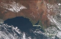
“There is a risk of damaging winds across a broad area of the state, roughly south of Streaky Bay to Port Pirie to Renmark – this includes the Adelaide metropolitan area,” said Bureau senior forecaster, Matt Bass.
“We are urging people in those areas, particular those taking advantage of school holidays and are not familiar with the region they’re visiting, to keep up to date with the latest weather warnings and safety messages.
“Be aware that driving conditions and some outdoor activities may be hazardous. Beware of fallen trees or debris on the road and keep clear of fallen powerlines,” said SES Chief of Staff, Trevor Arnold.
The Bureau is forecasting potentially damaging winds along the coast and the ranges. Strong winds will also accompany squally showers and thunderstorms.
The winds are a result of a strong cold front sweeping across South Australia, bringing with it bursts of heavy rain.
“The heaviest rainfall and strongest winds for Adelaide are likely to be from Wednesday mid-afternoon through to the evening, including the afternoon commute, so drive to the conditions and stay safe,” said Matt Bass.
“We’re asking communities to be aware this could cause minor street flooding. We’re urging motorists to not drive, ride or walk through floodwater and keep clear of creeks and storm drains. And also check your gutters,” said Trevor Arnold.
Mount Lofty Ranges, parts of lower south east of the state and Kangaroo Island are expected to receive 15-30 mm of rainfall on Wednesday, with isolated heavier falls possible.
Windy, wet and wintery conditions are expected to persist across the south of SA through to the end of the week, with another front expected on Friday.
There will also be rough, hazardous conditions on coast.
“If you’re along the coast or considering water activities, please check our warning and monitor the conditions as we’re expecting significant wave heights of more than 5 metres along exposed southern coasts to develop Wednesday, persisting Thursday and increasing 6-8 metres on Friday,” said Matt Bass.
“If you’re visiting the coast, make sure you observe safety signage and stay well back from the wave zone and for boaties, re-consider activities on the water,” said Trevor Arnold.


