Bangkok, Thailand – 20-21 June 2023 Natural hazards, climate change, unplanned urban growth, deforestation, environmental degradation, and scarcity of natural resources are hindering the progress of LDCs, LLDCs and SIDS in building resilient cities and communities. The IPCC AR6 report released earlier this year makes clear that the risks of inaction on climate are immense and the way ahead requires change at a scale not seen before. Climate impacts on people and ecosystems are more widespread and severe than expected, and future risks will escalate rapidly with every fraction of a degree of warming.
To address these challenges, UNOSAT with the support of the Norwegian Agency for Development Cooperation (NORAD) and in partnership with the Commonwealth Secretariat is assisting vulnerable countries from Asia-Pacific and Africa (Bangladesh, Bhutan, Fiji, Lao PDR, Nigeria, Solomon Islands, Uganda, and Vanuatu) through a three-year project (2021-2024) to strengthen capacities in the use of geospatial information for improving resilience.
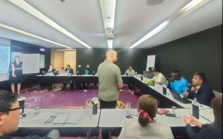
The Midline event organized in Bangkok steered at focusing and addressing pertinent issues faced by the target countries, in the form of discussions and presentations with all its stakeholders and experts under one umbrella.
The first day of the event commenced with a daylong orientation session, which included talks from several participants. An in-depth discussion on all the concerned project areas was done extensively and the possible gaps were identified to take effective actions. The event was successful in bringing together all the stakeholders, decision-makers, experts and practitioners in sharing knowledge and experiences from their regions and finding solutions to look forward to the third year of the project.
In his opening remarks Mr. Luca Dell’Oro, Chief of Disaster Risk Management and Climate Resilience Section, UNOSAT emphasized the role of geospatial technologies for coordinated and integrated approaches to effectively tackle the challenges posed by climate change and its impacts.
He said that “the key aim for UNOSAT is to enhance the capacity of different stakeholders including decision makers to understand and incorporate geospatial technologies in decision making for targeted intervention in adaptation plans, policies and investment decisions.”
UNOSAT’s in-country GIS experts and Country representatives also presented various aspects related to the areas of project interventions. The beneficiary project countries also highlighted the climate challenges that they were facing and how UNOSAT’s intervention contributes to building the climate resilience strategies, which can roughly be divided into 4 categories for every country: Technical Training, Technical Backstopping, Web-Solutions, and Contributing/Organising awareness-raising events in regular intervals. The mid-line event provided an opportunity to showcase the web platforms and solutions co-developed by UNOSAT and its respective country focal points and institutions, which will be beneficial for its end users.
The second day of the workshop focused on generating discussion about opportunities and challenges and progress of the project and what can be done differently (if anything) to ensure results and sustainability of the overall project and the way forward through its final year. Also, in addition, a Midline Evaluation was conducted by the Planning Performance Monitoring and Evaluation (PPME) Unit of UNITAR. This activity was led by Mr Jose Antonio Cabo Bujan (Independent Evaluator) and Ms Katinka Koke, Specialist, PPME, UNITAR. They interacted with the country representatives to assess their understanding and progress on the ongoing project and to” harvest” the results of the project since its commencement. Participants also took part in lessons-learned exercises and highlighted the importance of country ownership, collaboration and coordination, country exchanges, open-source software and good communication for the success of the project.
Mr Kushaal Raj, Head of Climate Change & Operations, Ministry of Economy (MoE), Fiji, said that “Thanks to the project we were able to reduce the response time during a cyclone. We have used the multi-factor decision-making tool and it has informed us on how to undertake recovery options.”
The support to countries by UNOSAT was commended by Mr Barnabas Bago, Ministry of Environment Climate Change, Disaster Management & Meteorology (MECDM) Solomon Islands, who observed that “The mapping of initial impacts is now quicker. It used to take us 3-4 days but was accelerated during cyclone Judy in 2023”.
Overall, the event served as a powerful avenue for exchanging knowledge among participants. It promoted integrated approaches, inspired decisive action in the realms of disaster risk management and climate action and in taking stock of progress by planning the work plan for the upcoming year.


