Key points
- CSIRO and Macquarie University are partnering with ACEN to pioneer smarter vegetation management for solar farms.
- AI-driven monitoring from space allows farmers to have confidence in their grass length and aridity.
- This research could be a useful tool in the toolkit for farmers and solar farm operators.
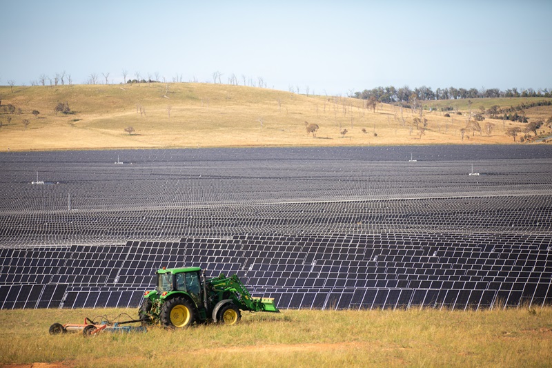
For insurers and operators alike, what grows under a solar array is almost as important as what sits on top of it. Grass height, moisture and biomass all influence how a site is insured, maintained and grazed.
At ACEN Australia’s New England Solar site in New South Wales, a collaboration with CSIRO and Macquarie University is using satellite‑based remote sensing and artificial intelligence (AI) to bring new precision to vegetation management, fire preparedness and day‑to‑day operations.
As CSIRO senior photovoltaic scientist Kenrick Anderson explained, today’s solar farms must constantly balance two competing demands.
“On one hand, you have solar farms wanting to keep grass levels down to reduce fire risk and keep insurers happy,” he told Energy. “On the other hand, the farmer, which is leasing the land to the solar operator, prefers higher grass levels for grazing purposes.”
Higher grass levels are also preferred by farmers to mitigate the ingestion risk of barber’s pole worm – a fatal, blood-sucking parasite common in Queensland and the northern half of NSW.
“Industries are trying to find a ‘happy medium’ in grass length: short enough for insurers and fire services, long enough for graziers’ livestock health and productivity – all in a climate where droughts and extreme rainfall events are becoming more frequent and severe,” Anderson said.
A smarter view
Until now, grass conditions have largely been determined through manual processes.
“We’ve worked with technicians who’ll drive by a site and go ‘1, 2, 3, 4’ to describe the grass length, with ‘1’ being the lowest and ‘4’ being the highest,” CSIRO principal research scientist Dr Cindy Ong told Energy.
“This provides limited insight, is subjective and introduces the chance for human error.”
Manual assessments are also time-consuming.
“A solar farm like ACEN’s spans 2000 hectares,” Anderson said. “To traverse the site and inspect everything is extremely labour intensive – a technician could cover hundreds of kilometres in the space of a few days.
“We’re hoping this research will unlock a new quantitative, repeatable system using satellites, airborne data, and field measurements to map vegetation fire risk across the entire site – and update it regularly.”
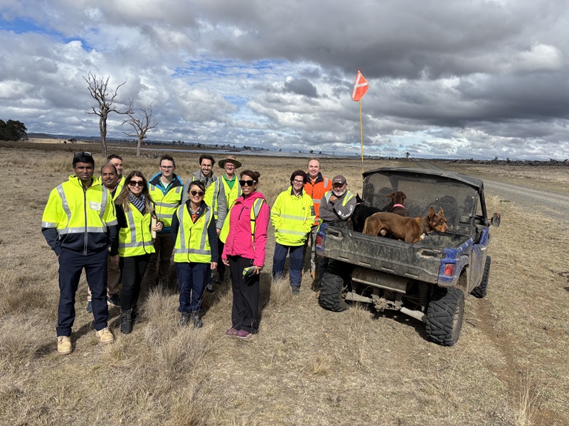
Nona Sepahrom , a CSIRO Industry PhD student from Macquarie University , has been tasked with the project. She is using hyperspectral imagery from Germany’s EnMAP satellite to measure vegetation down to a biochemical element.
“For utility-scale solar operators, biochemical detail translates to something practical: the ability to distinguish green, moist biomass from dry, flammable fuel, and see how that fuel is distributed around high‑value assets such as transformers and cabling,” Dr Ong said.
“This is how we determine fire risk in a quantitative form. It can also help farmers better manage their grazing patterns and work collaboratively with the solar farm operator to balance both the fire risk and yield of a farm.”
Using field samples and satellite imagery, Sepahrom is building a larger, more crystallised picture of ACEN’s New England Solar site.
“Once I’ve rationalised lab and satellite information, I will use specific spectral features learnt from the lab and satellite to classify the solar farm into distinct vegetation characteristics,” Sepahrom told Energy.
“I will compare this information across seasons, see how vegetation changes, and determine which parts of the farm are becoming drier and increasing the bushfire risk.
“Understanding historical and concurrent weather data is also important as precipitation, temperature, wind and sun exposure have a direct impact on vegetation growth. This is another source of information for the AI model.”
These insights will inform maps and models that illustrate vegetation condition, biomass, moisture and a fire‑risk score for each part of the solar farm, tracked across seasons and years.
This will help determine which parts of the farm are more prone to bushfire, and which sections need grazing or slashing intervention.
Scaling the solution
In the longer term, Anderson sees these models becoming part of a solar farm operator’s control room toolkit.
“The hope is for solar farm operators to be able to visualise their site and vegetation in real time,” he said. “A software platform could illustrate the fire risk at any point in time, enabling operators to make educated decisions on-site.
“By accruing more data, we could then build predictive models. This would help farmers optimise grazing patterns or slash a field in preparation for dry or wet weather coming.”
While the current work is centred on ACEN Australia’s New England Solar site, the underlying challenge – balancing vegetation, fire risk and co‑grazing on large renewable sites – is an industry‑wide issue.
“I’ve talked to plenty of solar farm operators – this challenge is on everyone’s mind,” Anderson said. “This solution could be rolled out across other utility‑scale solar and wind farms, supporting both operators and graziers.”
This solution is part of CSIRO’s broader solar work , which aims to increase the efficiency of solar farms while decreasing cost and risk.

ACEN Australia managing director David Pollington believes this project can set an important example for the wider Australian renewable energy industry.
“Through this research, we aim to help build industry confidence in agrivoltaics and livestock grazing as a viable long-term land management approach … and demonstrate how grazing operations can be maintained or even enhanced alongside solar generation,” he said.
“The project also highlights the value of working closely with host landholders and investing in research that delivers tangible benefits for farming businesses.
“Ultimately, it demonstrates that renewable energy projects can be partners in rural land stewardship, creating shared value for landholders, communities and the clean energy sector.”
For Sepahrom, remote sensing is as much a mindset shift as a technical tool.
“It gives me the feeling that I am a bird flying across the solar farm,” she said. “I can visualise everything from one viewpoint instead of traversing the site to gather my insights. It makes everything easier.”
In a world of hotter summers and tighter margins, that bird’s‑eye view may soon be indispensable for keeping operators, farmers and insurers happy.
This article was originally published in Energy Magazine