Key points
- CSIRO research vessel (RV) Investigator travels widely across Australia’s oceans and uses a suite of advanced sonar systems to continuously map the seafloor everywhere it goes.
- In 2025, a new record was set for the maximum depth of seafloor mapped by the vessel, achieved while sailing over the Tonga Trench in the Pacific Ocean.
- Under a new initiative, RV Investigator will help improve Australia’s seafloor mapping by delivering targeted surveys to replace lower quality seafloor data, particularly from the deep ocean, with updated, high-quality datasets.
Australia’s ocean territory is vast and covers an area more than 1.5 times the nation’s landmass. Within these waters is an incredible diversity of resources, marine species and habitats. And they’re deep. Excluding Antarctic waters, 70 per cent of Australia’s ocean territory is deeper than 1,000 metres and nearly 50 per cent is deeper than 3,000 metres.
So, what are the deepest points of the ocean in our region and how deep have we mapped the seafloor with RV Investigator?
Before we answer that, we need to understand how we map the seafloor.
1, 2, 3 seafloor mapping systems
Seafloor mapping is done by measuring the depth of the ocean above it. This measurement is called bathymetry , which literally means ‘depth measuring.’ By taking multiple ocean depth measurements and combining them, a map of the shape of the seafloor beneath the ocean can be generated.
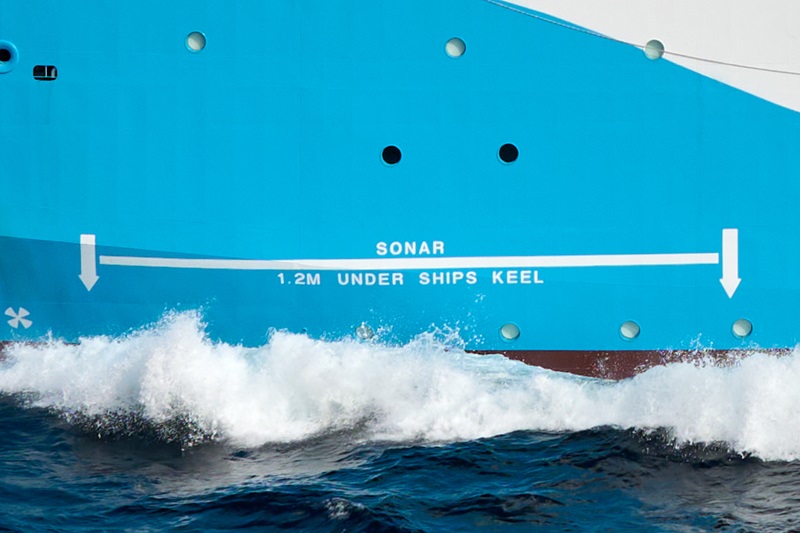
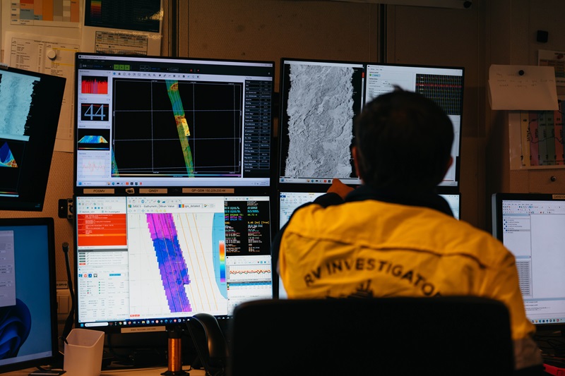
RV Investigator maps the seafloor using three separate multibeam echosounders (MBES) , also known as sonar or acoustic systems. These systems use pulses of sound (‘pings’) to measure the depth of the ocean and the three systems are designed for use in different depths of water (and operate at different frequencies of sound). The systems are all located in a special wing-shaped structure called a ‘gondola’ found under the bow of RV Investigator.
The vessel has a shallow-water MBES that enables high resolution seafloor mapping down to 200 metres, a mid-water MBES that operates to 2,000 metres and a deep-water MBES that can operate to full ocean depth of 11,000 metres. This means that RV Investigator can map to the deepest known point on the planet, which is a depth of 10,935 metres at a point called Challenger Deep in the Mariana Trench east of the Philippines.
At these depths, RV Investigator can map, in a single pass, a strip of seafloor called a ‘swath’ that may be up to 40 kilometres wide. This means teams are mapping the seafloor well beyond the horizon they can see from onboard, which is about 5 kilometres away.
So how deep has RV Investigator mapped the seafloor?
Mapping the second deepest point on the planet
In 2025, RV Investigator achieved its record depth for seabed mapping following a voyage to investigate the aftermath of the 2022 Hunga Volcano eruption . At the end of voyage, equipment trials required the voyage team to seek out the deepest water they could find.
Conveniently, the second deepest point on the planet was nearby.
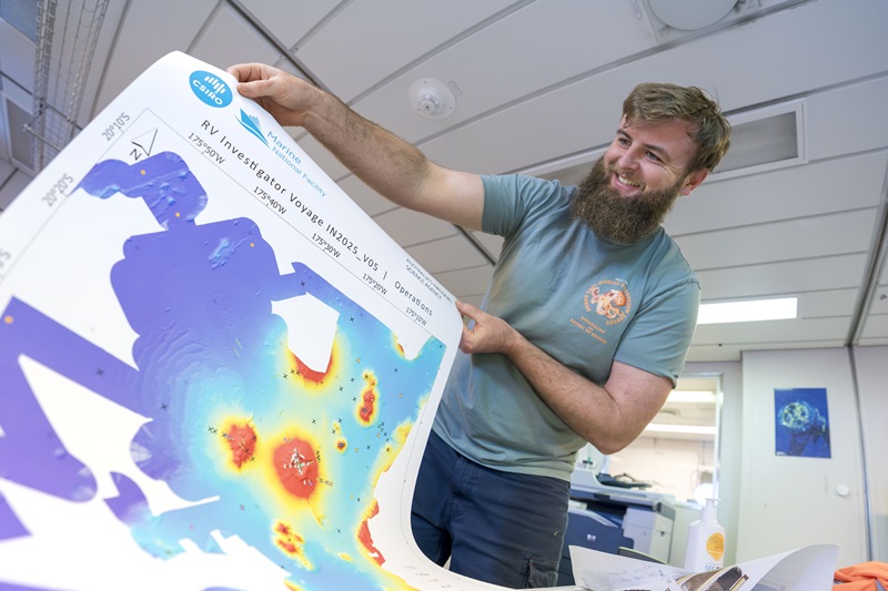
To the east of the islands of the Kingdom of Tonga lies the Tonga Trench. This contains a point called Horizon Deep which plunges to a crushing depth of 10,882 metres. While passing over the Tonga Trench during the 2025 voyage, the team aboard RV Investigator put the vessels’ sonar systems to the test and mapped the seafloor to a depth of 9,888 metres.
It’s not every day you’re on a vessel with nearly 10 kilometres of ocean beneath you!
How deep is the ocean around Australia?
Within Australia’s maritime territory, the deepest point in the ocean is approximately 7,000 metres in the Sunda Trench, also known as the Java Trench, off Christmas Island (RV Investigator mapped in this region in 2021 and 2022 ). This is a little studied, arc-shaped deep-ocean trench that stretches from Christmas Island across a distance of around 3,200 kilometres offshore from the islands of Java and Sumatra.
Other deepest points within Australia’s maritime territory include the Diamantina Fracture Zone off south Western Australia at approximately 6,400 metres (RV Investigator mapped in this region in 2020 ) and the Macquarie Trench near Macquarie Island in the Southern Ocean which plunges to depths beyond 6,300 metres (RV Investigator mapped in this region in 2020 ).
The Diamantina Fracture Zone recently hit the news as the site of the world’s biggest whale graveyard found at depths to 7,000 metres (located outside Australia’s ocean territory).
Even outside these extreme depths, there’s no shortage of work for RV Investigator’s deep-water mapping systems on voyages around the continent.

Upscaling Australia’s seafloor mapping
RV Investigator is further increasing its contribution to seafloor mapping for Australia through the Australian Government’s Resourcing Australia’s Prosperity initiative . Led by Geoscience Australia , the initiative will produce Australia-wide foundational geoscience datasets and detailed seabed feature maps. RV Investigator’s deep-ocean mapping capabilities will be applied to update and replace lower quality seafloor datasets.
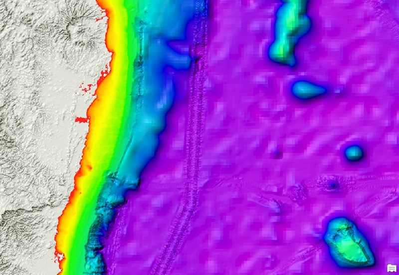
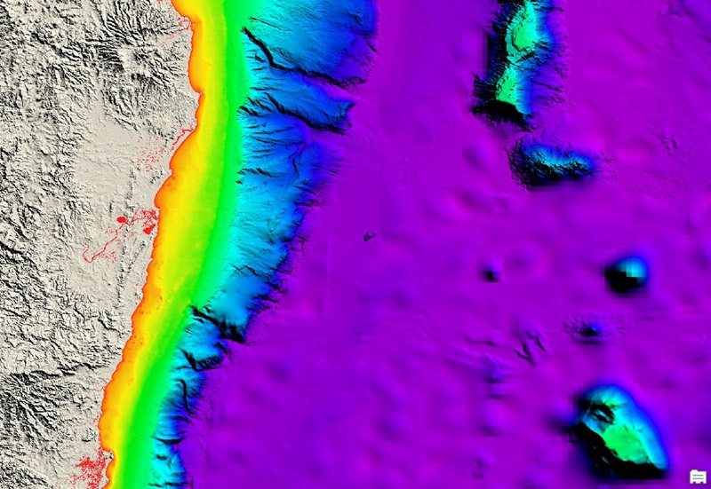
The first voyage contributing to this initiative will be delivered in July 2026 through a collaboration between CSIRO, Geoscience Australia, and James Cook University . Led by Dr Rob Beaman AM from James Cook University, RV Investigator will undertake a targeted deep-ocean survey to improve a 2,200 kilometre strip of lower quality seafloor mapping along the east coast of Australia from Hobart to Brisbane. The mapping will include ocean depths up to 4,500 metres or more.
The new dataset will be used to update the flagship Australian Bathymetry and Topography (AusBathyTopo) dataset, specifically the annually released national 250 metre bathymetry grid. It will also be used to improve the General Bathymetric Chart of the Oceans (GEBCO) , which seeks to provide the most authorative, publicly available bathymetry dataset for the world’s oceans.
Mapping to understand, manage and secure Australia’s oceans
Seafloor mapping is critical to our understanding of the ocean . The seabed dictates how ocean currents move, how marine ecosystems function and how human infrastructure, such as undersea cables and coastal developments, is built. It helps inform safe navigation for shipping and protect coastal communities by modelling risk from natural hazards such as landslides on the seafloor which could generate tsunami .
Equally important, it informs conservation planning and provided crucial information for Parks Australia, which manages the Australian Marine Parks network. Mapping seabed features is important for characterising habitat types, which supports understanding of biodiversity, informs conservation efforts, and guides marine park zoning.
With only 38.8 per cent of Australia’s maritime territory mapped in sufficient detail for effective ocean management, there’s still much more work for the collaborative teams mapping the seafloor onboard RV Investigator.