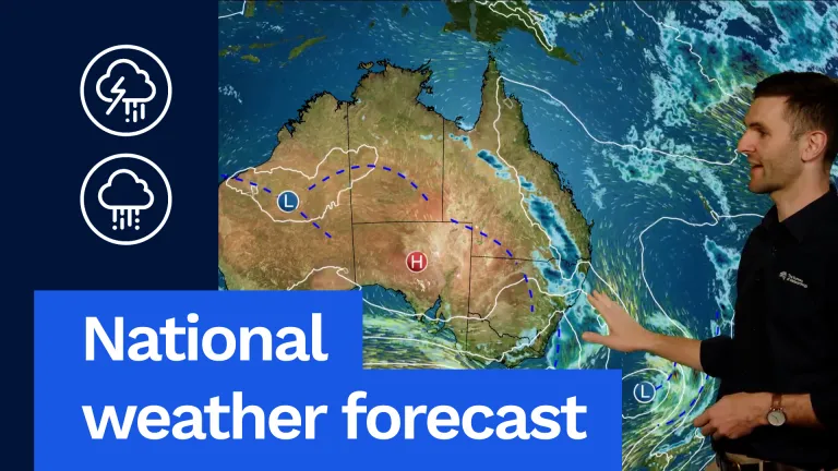
Showers, gusty winds and snow to parts of Victoria and New South Wales, and eventually some cooler conditions into parts of north-east New South Wales and south-east Queensland.
But further west you can see this massive high pressure system in the Indian Ocean extends a ridge right across southern, central and northern Australia.
That’s going to bring cooler conditions and drier conditions for much of the rest of the country. But let’s have a look at all of this weather in more detail.
Firstly, in Queensland we’re going to see a pretty warm day ahead of that wind change across eastern and northern Queensland with temperatures 2 to 5 degrees above average. Even Rocky here, getting up into the low 30s and into the mid 30s for far northern parts of Queensland. But much cooler in the south-west behind that change only getting into the low 20s in the south and southern inland areas getting into the mid 20s as well through parts of south-eastern Queensland as well ahead of that change. And for Brisbane, if you’re heading to the Ekka, looking like a nice day. Partly cloudy conditions and gusty winds, although that cooler change may reach those south-east Queensland and Brisbane in the late afternoon and evening and we’ll see a bit of a drop in temperature with those cold and gusty winds. But before that, Brisbane 25 °C and partly cloudy.
Moving down into New South Wales and while it’ll be a little bit milder in the north-east, much cooler across much of the rest of the state as showers, gusty winds continue to impact much of inland parts of New South Wales, with that next cold front moving through. May even see some snow about our alpine areas as well, maybe down to around 1400 m there in New South Wales, but pretty dry along the east coast with those gusty westerly winds and cool to mild as well, it will feel cool in those winds. Sydney looking at partly cloudy, 20 °C after a cool start.
Canberra a cold start, 2 °C, only warming up to 13 °C with showers, gusty wind and snow about those alpine areas outside of town. Showers also expected for much of western inland areas of New South Wales as well.
Moving down into Victoria and all eyes will be on this front, moving into western areas during the morning and sweeping across central and eastern parts of the state as we move into the afternoon and evening hours. Widespread showers expected right across the state as well. Snow around our alpine areas as well, down to around 1200 m there, and temperatures in the low to mid teens statewide. Melbourne looking at a showery 15 °C with gusty winds as that front moves through.
Moving down into Tasmania and you can see that front impacting the early hours of the morning and then sweeping across the state during the day. We’ll see that showers turn to rain for much of western Tasmania, with moderate falls possible there. Only light falls, though, expected through eastern parts and far north-eastern parts of the state as well. Temperatures in the low to mid teens through northern and eastern parts of Tasmania, turning quite cooler in the west and southern areas into the low teens and only just getting to 10 °C there in Queenstown. Hobart looking at a windy and showery day, 14 °C, with those heaviest falls will be on those westward-facing mountains.
As we move up into South Australia on Wednesday, we can see those showers are going to impact Tuesday night and Wednesday morning, but then quickly clear out before another weaker front impacts our coastal areas Wednesday afternoon and Wednesday night. Not looking anywhere as wet, and active as the system we saw impact us here on Saturday and Sunday, but generally still a showery one for our southern agricultural areas, tending to only isolated light showers around northern Agricultural areas and little, if anything, just gusty winds and cooler conditions through northern parts of the state. Temperatures in the mid to high teens right across the state. Adelaide looking at a shower in the morning, easing in the afternoon and 15 °C.
Moving over into Western Australia. And we’re going to see a cold and frosty night for many of our inland areas and through the Wheatbelt on Wednesday morning, so watch out for that. If you’re away from the coast, it will be a cold and frosty morning. Then it will be a mostly sunny day as high pressure system moves over and temperatures will be warming up into the high teens. So cold, frosty morning, but then a bright and sunny day. Even colder air going up into northern parts of WA as well. You can see temperatures there only just getting into the low 20s there. Perth will have a cold morning down to 5 °C and maybe even colder in some of the suburbs, dropping up to a partly cloudy 19 °C during the afternoon.
And finally across our tropical north and in the dry season this time of year, staying pretty warm. Ahead of that cooler change across northern areas. You can see temperatures here into the mid 30s, so a warm one there as well and that also extends into the Kimberley as well. Much cooler though through the red centre, temperatures only getting into the mid to high teens there, but getting into the mid to high 30s through inland parts as well in the Top End. Darwin looking at a partly cloudy, 31 °C on Wednesday.
So a bit of weather in south-eastern parts and dry and sunny elsewhere.
Remember to get the latest forecast and warnings for your area via our website and the BOM Weather app. And I’ll be back again tomorrow for your Thursday forecast.
Video current: 2:00 pm AEST Tuesday 11/08/26.