Council has again thanked the local community for their continued patience as Wagga Wagga and surrounds continues to be affected by flooding and extreme weather events.
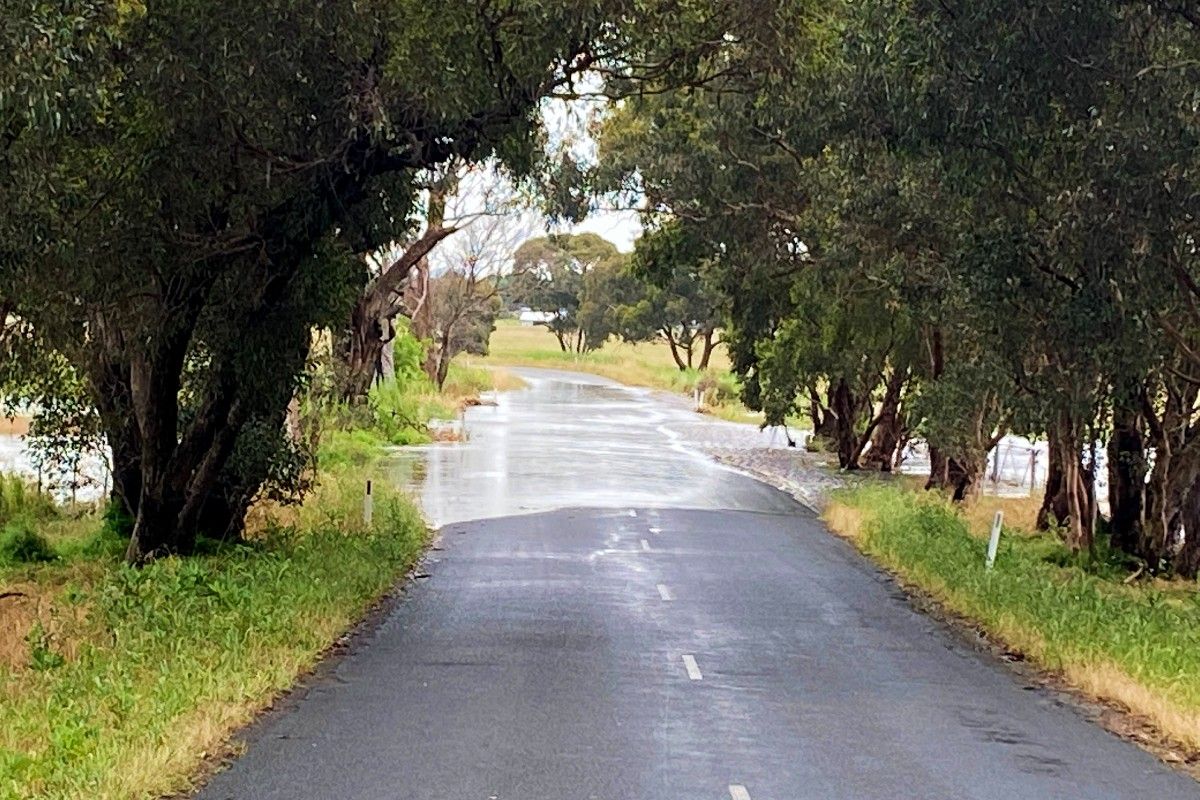
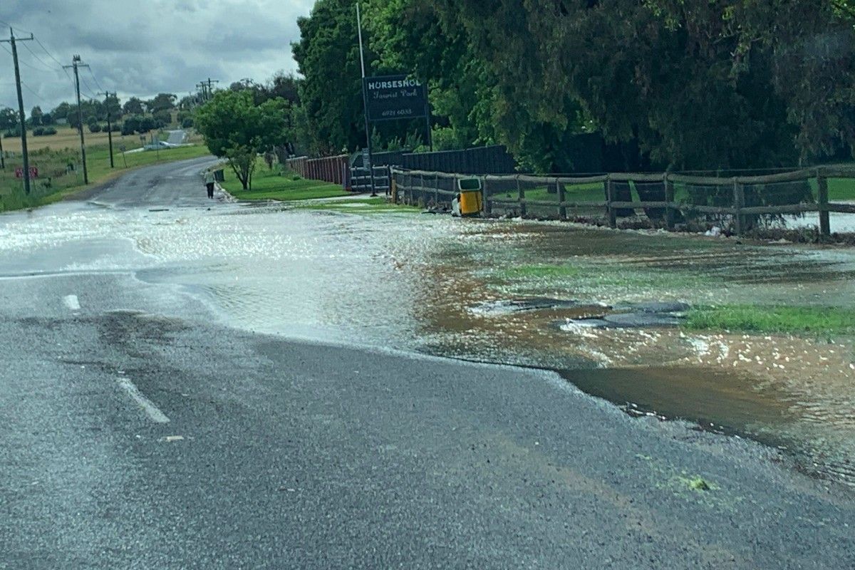
The Murrumbidgee River at Wagga Wagga peaked at the minor flood level of 8.06 metres on Tuesday evening, while some parts of the city experienced flash flooding as the result of storms on Saturday afternoon and Sunday morning (12 and 13 November).
Director of Infrastructure Services Warren Faulkner said while the flood peak has passed, the impacts of the flooding, particularly on the road network, will be felt for quite a while across the Local Government Area and region.
“We know the community is getting frustrated by the deterioration in the road network, but we ask for their understanding as we try to work through the damage assessment and repairs process,” Mr Faulkner said.
“Our patching crews are still working overtime trying to fix as many potholes as they can, while we are also carrying out emergency resealing works in some locations.
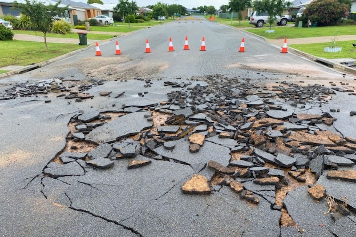
“The emergency works are about getting these roads back into a trafficable state, not a perfect state, ensuring they are safe and can be used by vehicles until we can do a proper reinstatement of the pavement.
“The timing of any restoration works will depend on the flood claim assessment process for funding and on resources, such as contract help and road building materials, which are going to be high demand after the massive destruction being experienced right across NSW and Victoria from flooding.”
To help ensure the public’s safety as well as halt any further deterioration of the pavement, Council is asking motorists to obey road closures and not drive through flooded roads.
Council is also reminding the community our Riverside playground and Wagga Beach carpark remain closed.
Strategic Asset Planner (Parks and Recreation) Ben Creighton said while flood waters are receding, sections of the precinct are still underwater.
“Depending on the weather, our staff will assess the playground next week and then remove the mud and debris from the back-to-back flooding events, before we clean and disinfect the area,” Mr Creighton said.
“We really appreciate your patience and will let you know as soon as we reopen.”
To stay up-to-date about local road closures, visit wagga.nsw.gov.au/flooding


