New GeoAI system allows for the first large-scale, long-term monitoring of vegetation in one of world’s most remote environments
Monitoring Antarctica’s tiny, scattered ecosystems is a challenge that has long plagued researchers. But a new study led by the University of Wollongong (UOW) has devised a new approach to tracking life in one of the most remote environments on Earth.
Combining ground surveys, drone imagery, satellite data and artificial intelligence, the team of researchers from the Australian Research Council’s Securing Antarctica’s Environmental Future (SAEF) developed an end-to-end geospatial AI framework that will allow them to study the continent’s complex biodiversity from anywhere in the world.
For the first time, the researchers can create cross-scale, long-term mapping of the subtle changes in Antarctica’s unique ecosystems, from granular patches of moss to huge swathes of the icy landscape. This will provide valuable data about the continent’s remarkable, yet understudied, flora and fauna, as Antarctica grapples with a significant shift in environmental conditions.
“We’re only beginning to understand the role that many of Antarctica’s least-studied species play in its ecosystems. Long-term monitoring is how we find out, and it’s essential if we want to protect Antarctica’s biodiversity as a whole, not just the parts people already know and love.
“Antarctic mosses, lichens and cyanobacteria often occur in very small and fragmented patches. While these communities can be studied in detail on the ground, their limited size and scattered distribution make large-scale monitoring difficult.
“We can observe this ecological detail in the field and with drones, but these approaches cover relatively small areas. Satellites, on the other hand, can repeatedly observe much larger landscapes, but at a much coarser spatial scale. Our idea was to connect these different scales, using detailed field observations to inform drone-based mapping, and then using those drone-derived observations to support satellite-scale monitoring.”
– Study lead author Dr Narmilan Amarasingam
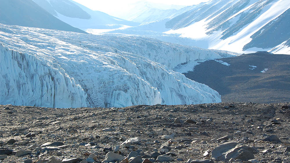
The landscape at Canada Glacier in the McMurdo Dry Valleys in Antarctica, where the field research was done.
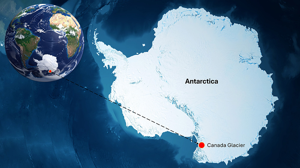
The team developed and tested the framework over seven years at Canada Glacier in the McMurdo Dry Valleys, an ice-free polar desert that is home to some of the most biologically productive vegetation in Antarctica. The new approach allowed them to capture a consistent and comprehensive picture of the ecosystem and terrain, from centimetre-sized patches to landscape-level patterns.
Tracking vegetation across multiple years helps scientists separate short-term variation from longer-term change as conditions in Antarctica are reshaped by the warming planet. The new framework could help inform how Antarctica is protected and managed, by providing large-scale data to support decision making, biodiversity modelling, and environmental management strategies.
“The aim is not to replace fieldwork. Field observations remain essential because they provide the biological understanding needed to interpret what we see remotely. Instead, approaches like this can help us make those valuable field observations work much harder by extending them across areas that are difficult, expensive and logistically challenging to revisit,”
– Dr Amarasingam
About the research
‘A multi-sensor and multi-temporal GeoAI framework for resolving ecological scale mismatch in Antarctica’ by Narmilan Amarasingam, Cassandra Newman, Melinda Waterman, Gabrielle Koerich, Elka Blackman, Ashray Doshi, Lennard Gillman, Charlotte Walshaw, Eva Nielsen, Tamara Pletzer, Johan Barthélemy, Sharon Robinson and Barbara Bollard, was published in ISPRS Journal of Photogrammetry and Remote Sensing: https://doi.org/10.1016/j.isprsjprs.2026.09.016
The UOW-led SAEF team worked with collaborators from the University of Canterbury, Eawag – Swiss Federal Institute of Aquatic Science and Technology, the University of Edinburgh, the Geological Survey of Denmark and Greenland, and NVIDIA.
The project was funded through the SAEF–Antarctic Science Platform Collaboration Fund, which helped bring together researchers and expertise across Australia, New Zealand and international partner organisations.
The broader research was also supported through SAEF and the New Zealand Antarctic Science Platform, with Antarctic field logistics provided by Antarctica New Zealand.