After a record decline in winter sea-ice extent this year, Australian Antarctic Program (AAP) scientists will be part of an international effort to help understand if it was a likely one-off occurrence or the transition to a climate tipping point.
AAP scientists Dr Petra Heil and Sean Chua will work with a New Zealand team* on a joint project to measure sea-ice thickness in the Ross Sea this summer, as part of ongoing efforts to measure, analyse and understand sea-ice changes around Antarctica.
The team, led by the University of Canterbury, will measure snow and sea ice using satellite, aerial and on-ground technologies.
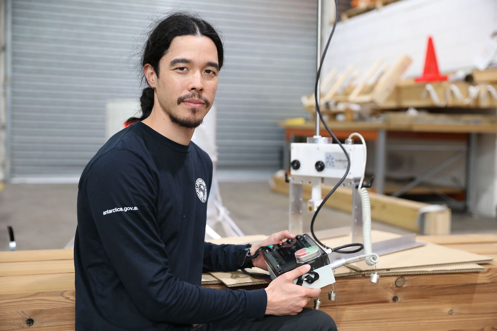
“An aerial team will conduct the first surveys of the region using a snow radar integrated into an electromagnetic instrument called an EMBird,” Sean said.
“Together these instruments will measure the thickness of the snow layer on the sea ice, and the total thickness of the sea ice and snow.
“I’ll be part of a ground team that will take measurements of both sea-ice thickness and snow thickness along a transect over the sea ice, to validate and calibrate simultaneous aerial and satellite measurements over the study location.”
To do this the ground team will use a sled carrying the same instruments as those in the EMBird, as the aircraft flies overhead.
Sean will also use a high-tech instrument, developed by the WSL Institute for Snow and Avalanche Research SLF in Switzerland, to measure the micro-structure of snow.
“I’ll use a SnowMicroPen to measure the structure of the snow cover on top of the sea ice in great detail,” he said.
“The instrument can measure the vertical density and crystal structure of a metre of snow in under one minute, at millimetre resolution.
“It’s so fast that we can take many more measurements in the time it would take us to dig and sample a traditional snow pit.”
The on-ground team need to understand the detailed structure and exact thickness of the snow cover because it affects satellite and aerial measurements of the sea-ice thickness beneath. This is because snow may contain icy layers, due to melting and refreezing, winds, compression and flooding, which can give false readings for icy horizons from aerial- and satellite-mounted instruments.
“The idea is that once you’ve got a good set of calibration data from the ground, you can then fly a campaign covering hundreds of kilometres of sea ice per day, without the need for further ground measurements,” Dr Heil said.
Along with his time- and effort-saving SnowMicroPen, Sean will assess snow structure by digging traditional snow pits under the flight path.
Snow pits extend from the surface to the sea ice below and can be metres deep. Scientists then take samples from the vertical face of the pit, to measure properties including density, crystal structure and temperature, as well as properties the SnowMicroPen can’t measure, like salinity.
Sean will also measure sea-ice thickness by drilling holes through the sea ice and dropping down a measuring tape.
Sea ice, and the snow layer that accumulates on top, are a critical regulator of Earth’s climate system and its response to atmospheric and ocean warming.
Bare sea ice reflects between 50 and 70 per cent of incoming solar radiation, while snow-covered sea ice reflects up to 90 per cent, depending on its structure. Snow also acts as an insulating blanket between the atmosphere and the sea ice, slowing or stopping melting in the summer.
“The data collected by this project will help verify satellite-derived estimates of sea-ice thickness, and enhance climate models to improve future sea-ice projections,” Dr Heil said.
*The research is supported by the New Zealand Marsden Fund, which provides grants for investigator-initiated research.


/who-and-sesam-event-in-lyon.tmb-768v.jpg?sfvrsn=6788f1a1_1)


