A research voyage aimed at shedding light on Macquarie Island’s underlying structure and geological evolution, while also enabling monitoring of future earthquakes and tsunamis that could affect Australia and New Zealand, will this week sail from Hobart.
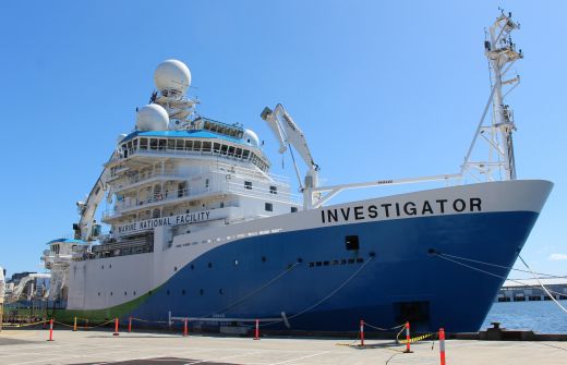
Led by Institute for Marine and Antarctic Studies (IMAS) Professor Mike Coffin and including scientists from ANU, the voyage on Australia’s national research vessel Investigator, owned and operated by CSIRO, will allow researchers to produce the first high-resolution maps of the seafloor surrounding Macquarie Island, much of it lying within the island’s nature reserve and Macquarie Island Marine Park.
At the same time, ANU scientists led by Professor Hrvoje Tkalčić will deploy seismometers on the seafloor around the island to allow them to investigate the region’s crustal and mantle structure as well as its seismicity.
Professor Coffin said Macquarie Island sits on the highly active tectonic plate boundary between the Australian and Pacific plates and generates some of the largest intra-oceanic earthquakes away from subduction zones.
“The creation of seafloor maps identifying faults, fracture zones, and relict seafloor spreading centres will yield insights into the structure, behaviour, and history of this important plate boundary, which presents significant tsunami hazards for both sides of the Tasman Sea,” Professor Coffin said.
“The maps will also shed light on why and how Macquarie Island, which formed around 2500 metres below sea level, was thrust above sea level.
“World Heritage-listed because of its unique geological exposures of both crustal and mantle rocks, the island hosts Australia’s only sub-Antarctic research station, which includes a seismometer,” Professor Coffin said.
Professor Tkalčić said the 29 seismometers to be deployed on the seafloor will be recovered in late 2021 or early 2022, returning data critical for addressing the project’s seismological objectives.
“Our research has two main aims: first, to image Earth structure by utilising state-of-the-art seismological techniques in conjunction with a carefully designed configuration of ocean bottom seismometers pointing towards the Earth’s centre like a giant antenna; second, to elucidate the physics of the world’s largest underwater earthquakes not associated with active subduction.
“Such a remote and unique location chosen for our experiment will also improve the spatial coverage of the Earth’s deepest interior by seismic waves of distant earthquakes recorded by our seismometer array, and enable a range of geophysical studies, including interactions of the ocean and atmosphere with the solid Earth,” Professor Tkalčić said.
RV Investigator leaves Hobart on Friday, 9 October, and is scheduled to return on Sunday, 1 November.


