A series of strong cold fronts is forecast to cross New South Wales between Thursday and Sunday, accompanied by very windy conditions, showers and possible thunderstorms in some areas.
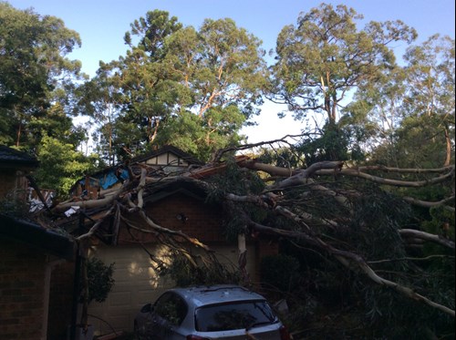
Damaging winds are likely to develop about the Alpine areas during Thursday, with potential to become more widespread about the ranges and coast during Friday, particularly in the southern parts of the state.
Snow levels on the southern ranges are expected to drop significantly during Thursday night or during Friday morning. The ski fields of the Snowy Mountains are likely to see some heavy snowfalls, with places like Thredbo and Perisher potentially accumulating a metre or more of snow. Snow showers are also forecast for areas which don’t see snow very often, such as parts of the central tablelands, and potentially about the northern tablelands on the weekend, places include Orange, Guyra, Barrington Tops and the Blue Mountains.
Daytime temperatures are forecast to be well below average for this time of year, especially Friday to Sunday, with wind-chill to make conditions feel even colder.
Showers and thunderstorms are likely to be quite gusty.
There is a current warning in place for a Severe Weather Warning for southern parts of New South Wales for Damaging Winds. For up to date warnings visit the Bureau of Meteorology website.
Now is the time to prepare, What you can do:
- Take the time this afternoon to move your car undercover and away from trees.
- Secure or put away loose items around your house, yard and balcony.
- Keep at least 8 metres away from fallen powerlines or objects that may be energised, such as fences


