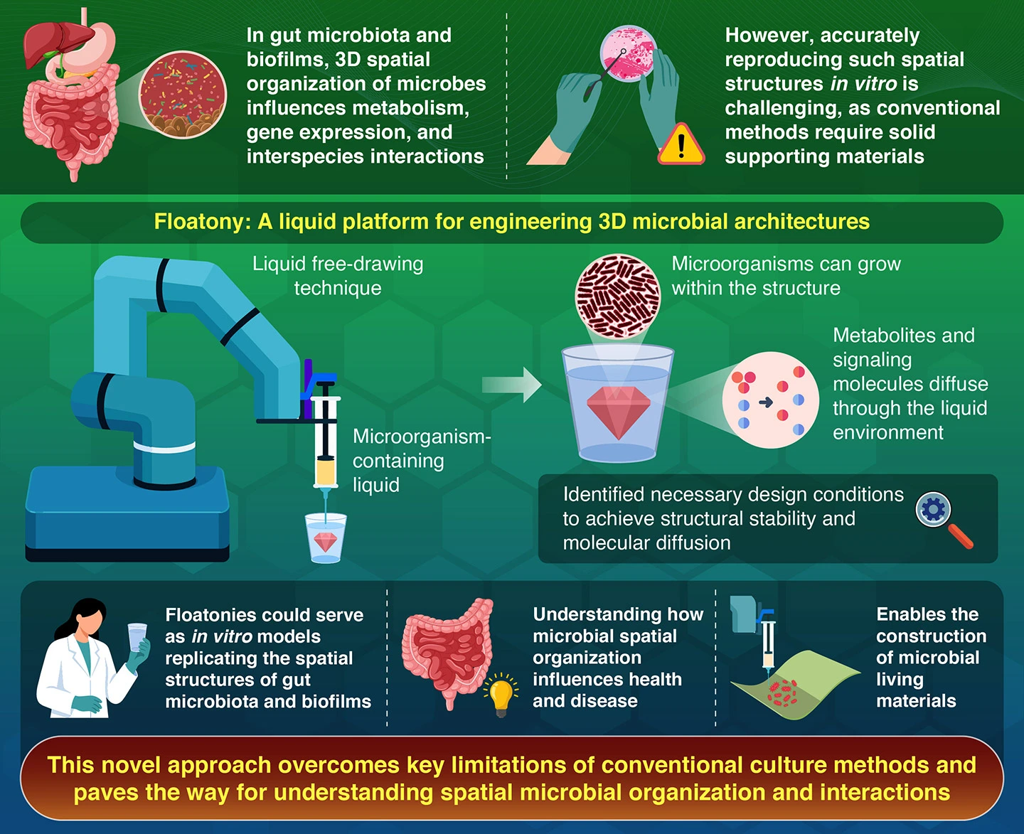
Issued: 3:30pm AEDT on Monday 21 March 2022
The Bureau of Meteorology has issued its Climate and Water Outllook for April to June, noting wetter than average conditions are likely to persist across parts of northern and eastern Australia.
The La Niña event behind this wetter outlook is likely to finish by late-autumn, with a return to neutral conditions – neither La Niña nor El Nino – in the tropical Pacific.
The outlook for April to June 2022 indicates above average rainfall is likely across most of the tropics and for parts of eastern Australia. Below average rainfall is likely across western Tasmania and south-west Western Australia, and warmer than average days and nights are likely for most regions.
“While parts of eastern Australia remain very wet, with saturated soils and swollen rivers, the outlook for above average rainfall in some areas highlights the importance of monitoring the BOM Weather app and Bureau website for the latest forecasts and warnings,” the Bureau of Meteorology’s Head of Long-Range Forecasts, Dr Andrew Watkins said.
“This has been the second La Niña in consecutive years, something last seen in 2010-2012.
“La Niña events typically break down in early to mid-autumn. However, trade winds remain stronger than average over the tropical Pacific Ocean delaying the further weakening of the La Niña over the past fortnight.
“Even if La Niña weakens, it will continue to influence global weather and climate,” Dr Watkins said.
For more details on this and other climate outlooks and summaries, visit the Bureau’s website: www.bom.gov.au/climate
The latest climate outlook can be viewed at: https://www.bom.gov.au/climate/outlooks


