Geoscience Australia has taken part in a global campaign to compare data from the Landsat 8 and 9 satellites during a rare underfly.
The Landsat 9 satellite was launched by NASA on 28 September 2021, to provide the next generation of Earth Observations from Space (EOS) data.
But a unique event in the lifetime of the satellite occurred between 13 and 17 November.
As Landsat 9 was being maneuvered to reach operational altitude, its orbital path overlapped with that of the older Landsat 8 satellite.
Geoscience Australia’s National Earth and Marine Observations Branch Head Maree Wilson said this “underfly” provided a rare opportunity for scientists to compare the performance of sensors on the sister satellites as they passed over the same area near-simultaneously.
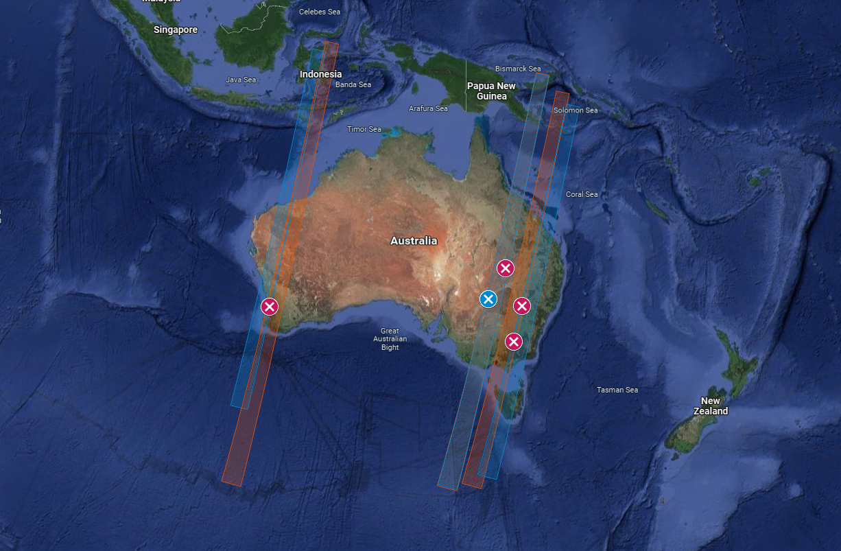
Sites where fieldwork was undertaken during the Landsat 8 – Landsat 9 underfly event. The swaths imaged by Landsat 8 are shown in red, while the swaths imaged by Landsat 9 are shown in blue
“This was our only opportunity to confirm both the Landsat 8 and 9 satellites are seeing the world in the same way,” Ms Wilson said.
“When Landsat 9 reaches its operational orbit, the orbits of the two satellites will be offset by 8 days, meaning this was the only chance we had to image the same swath of Australia with both satellites at the same time.
“It is important that we know the Landsat satellites are taking like-for-like measurements, as our ability to monitor the entire country and how it is changing depends on having a long, growing and consistent record of data from Landsat satellites.
“We use Landsat data to track changes in the landscape, identify waterbodies and monitor coastal erosion. Ensuring this data is accurate is vital for the health and wellbeing of all Australians.”
As part of a global mission led by the United States Geological Survey, Geoscience Australia coordinated field measurements at multiple sites around Australia, in collaboration with the Queensland Department of Environment and Science, University of Queensland, the New South Wales Department of Planning, Industry and Environment, CSIRO, University of Western Australia, and FrontierSI.
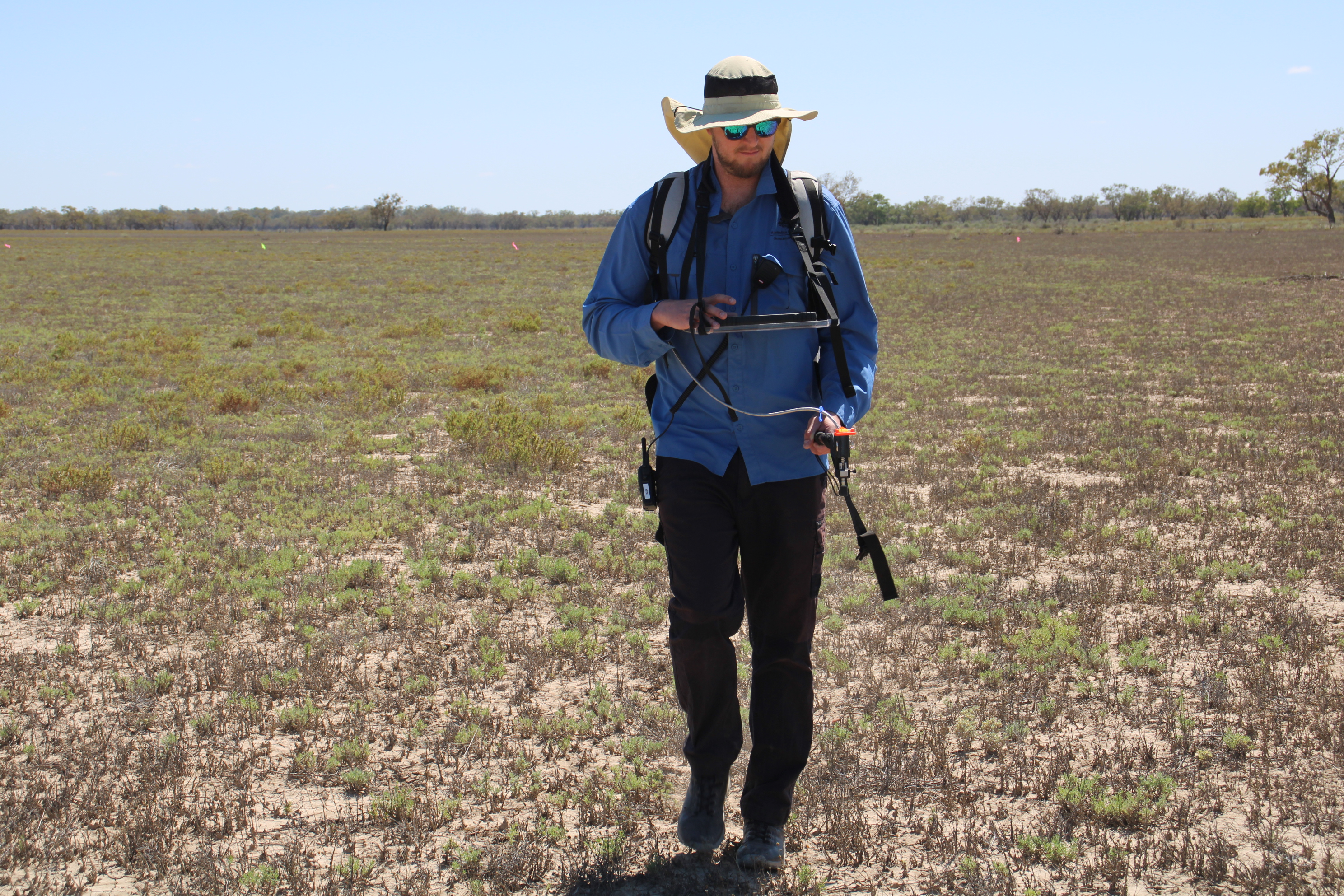
Geoscience Australia Spectral Data Quality Officer Eric Hay at Paroo-Darling State Conservation area near the Darling River on 15 November 2021 taking measurements during the Landsat 8/9 underfly
The exercise extended over five locations – Perth, Western Australia; Cunnamulla Queensland; Wilcannia, New South Wales; Narromine, New South Wales; and Lake Hume, New South Wales – to increase the chance of clear skies during the underfly.
Scientists used spectrometers – instruments that measure the intensity of reflected light at many wavelengths – to replicate the pixels in data acquired by Landsat 8 and 9 satellites when the swaths – or the areas of the Earth’s surface imaged by the satellites – overlapped.
“This nationwide collaboration is a great example of members of the Australian Earth observation community helping to provide confidence in the newest Landsat mission,” Ms Wilson said.
“While it may take some time for Geoscience Australia to receive all the satellite data, initial comparisons of recent Landsat 8 data over the field sites gives us a high degree of confidence in the field data collection.”
This campaign is just one way Geoscience Australia helps with effective utilisation of data from the Landsat program.
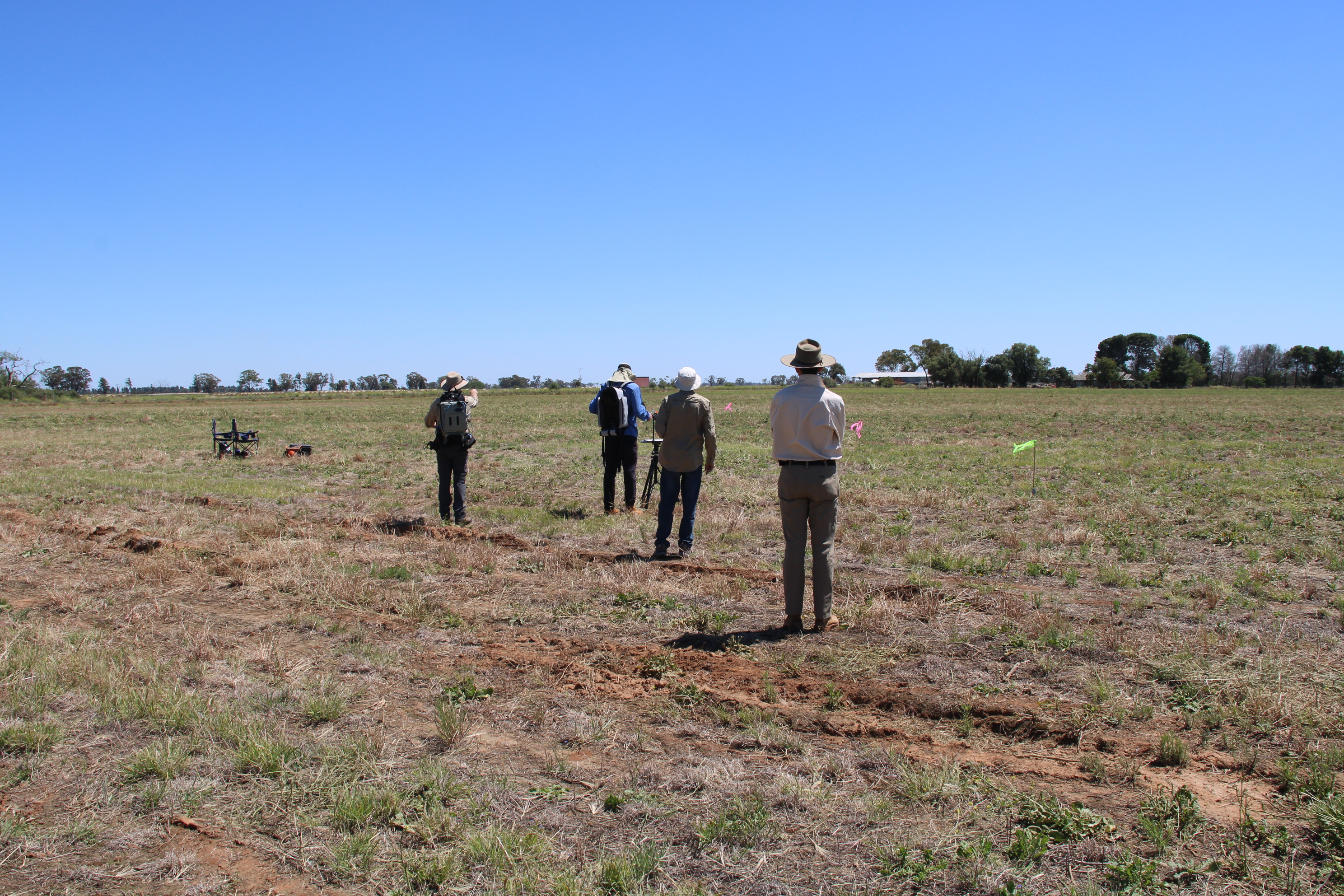
Geoscience Australia’s Guy Byrne, Eric Hay and Medhavy Thankappan with Tony Gill from the NSW Department of Planning, Industry and Environment, undertaking field measurements in Narromine, NSW on 17 November 2021
Geoscience Australia’s satellite ground station at Alice Springs is also one of five stations globally that makes up the United States Geological Survey’s Landsat Ground Network and is now providing regular support to the satellite.
Geoscience Australia’s Digital Earth Australia program also makes Landsat data freely accessible through products such as DEA Coastlines.
“This calibration work will enable Geoscience Australia to continue to provide government, businesses and industry with this high-quality satellite data,” Ms Wilson said.


